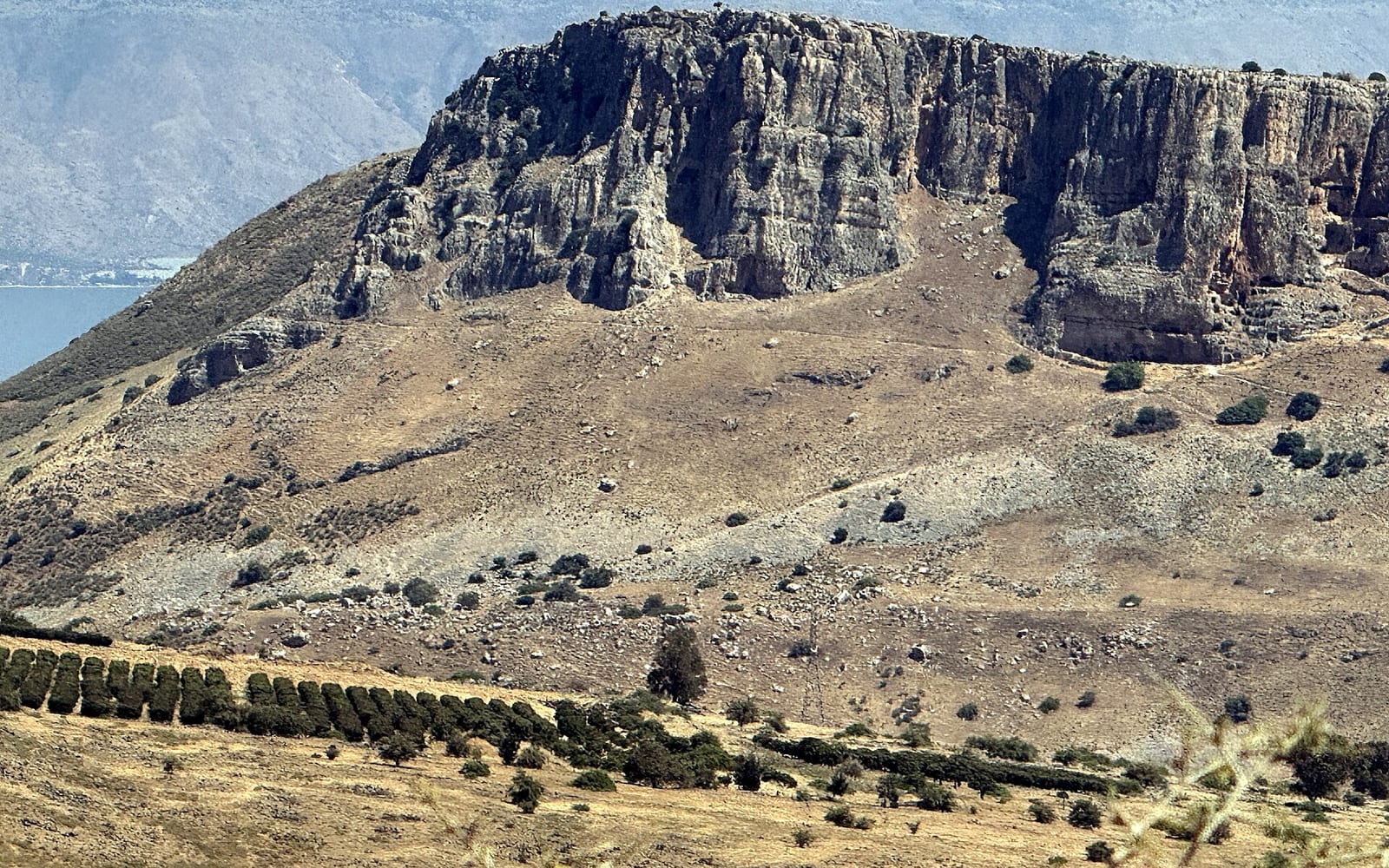
Mount Arbel rises 380 metres directly above the western shore of the Sea of Galilee and holds one of Israel’s most distinctive cliff-face hikes — a chain of fixed hand-holds and steel cables down a Bronze Age natural defensive descent, ending in the Arbel caves that served as Jewish refuge bunkers during the Hasmonean revolt against Rome. From the summit, the panorama covers the entire Sea of Galilee, the Golan Heights, the Jordan Valley and on clear winter days the snow on Mount Hermon.
The site is a designated national park managed by the Israel Nature and Parks Authority. The full hiking loop combines summit-to-summit panorama walk, cliff descent with caves, and a gentler northern return — three hours at a moderate pace. Shorter visits to the panorama lookout only take an hour round trip.
Need to know
| Cost | Standard Israel National Parks entrance fee (~₪22–28 / ~$6–8); free with the annual parks pass. |
| Hours | Daily 08:00–17:00 (summer) / 08:00–16:00 (winter); last entry well before closing. |
| Time needed | Full cliff-descent loop ~3 hours; summit panorama walk only ~1 hour round trip. |
| Getting there | ~15 min by car south-west of Tiberias via Route 77 to the upper car park (paid). Public transport is limited; rental car or hiking tour is practical. |
| Best time | Start early (by 07:30 summer, 09:00 winter) for cooler conditions and the strongest panorama light; do the descent in good daylight. |
| Accessibility | Summit panorama route suits anyone who can manage a short hill walk; the cliff descent uses fixed cables and hand-holds and is not suitable for vertigo, balance issues, very young children or limited mobility. |
What is Mount Arbel?
Mount Arbel is a basalt-and-limestone cliff face above the western Sea of Galilee shore, just inland from the modern town of Tiberias. The cliff drops about 380 metres in a sharp face down to the Wadi Hamam valley below. The Arbel caves carved into the cliff face are a natural rock-shelter system that humans have used since the Stone Age and that Hasmonean rebels fortified into a defensive bunker complex during the 1st-century BCE revolts described by Josephus. The cliff descent route uses the same paths and hand-holds that have been in continuous use for over two millennia.
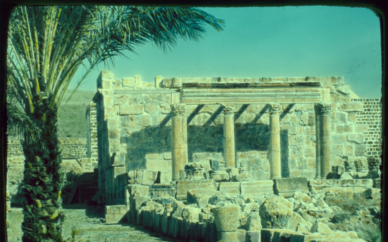
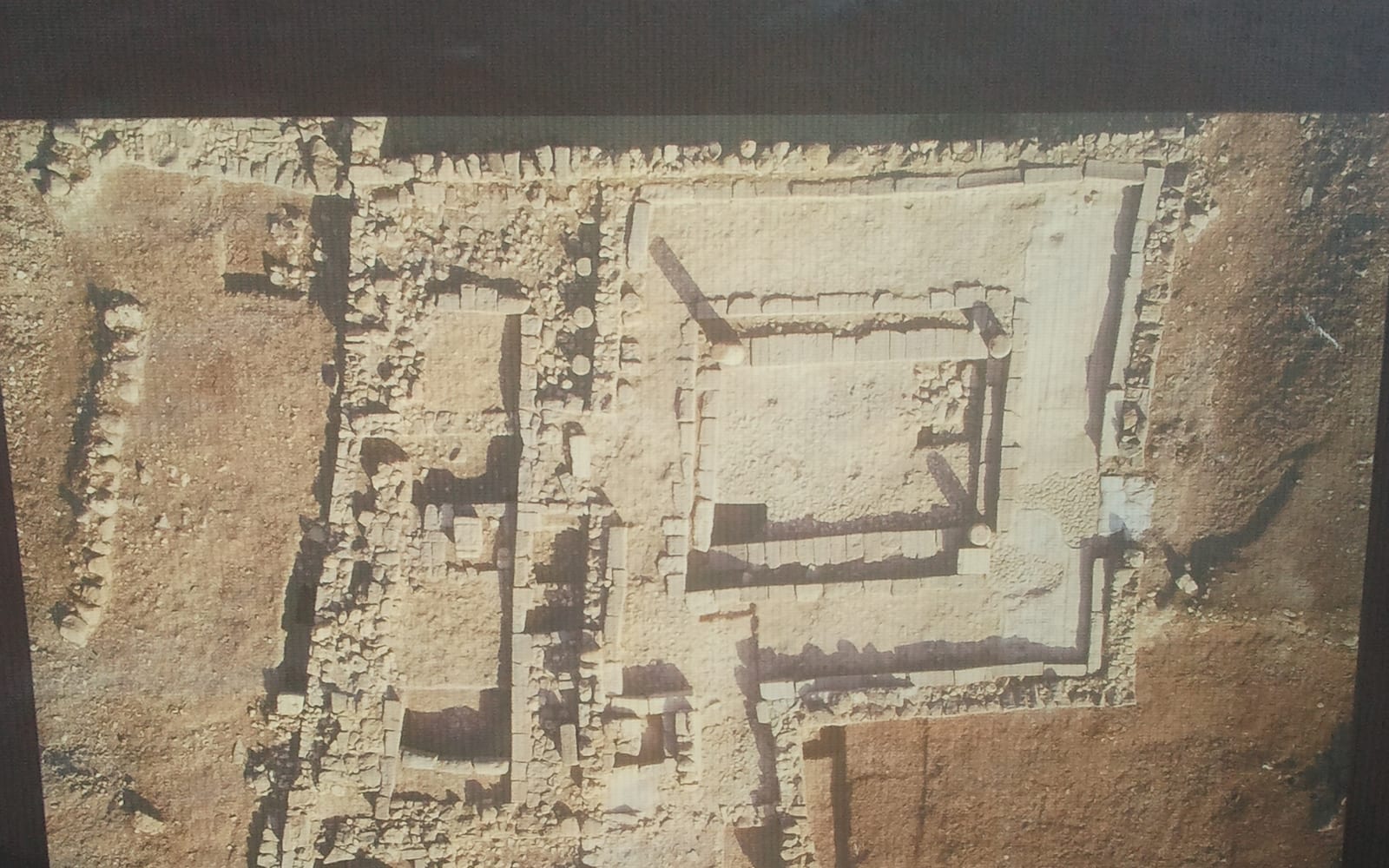
The summit area holds the remains of an ancient synagogue (4th to 6th century CE), reflecting the Jewish village that sat on the plateau in the Roman and Byzantine periods. The plateau today is a quiet hiking corridor with views in every direction.
Visiting Mount Arbel Today
Access: 15 minutes by car south-west of Tiberias via Route 77. The upper car park at the summit area is the starting point for both the panorama walk and the cliff descent; there is also a lower car park accessible by a separate road from the Wadi Hamam side. Public bus service is limited; a rental car or organised hiking tour from Tiberias is the practical option. Hours: national park open daily 08:00 to 17:00 (summer) / 08:00 to 16:00 (winter). Cost: standard Israel National Parks entrance fee. Equipment: sturdy hiking shoes, water, sun protection, gloves for the cliff descent are useful.
Atmosphere: the site is quieter than the Christian pilgrim circuit further north and attracts mostly Israeli hikers, foreign nature-tourists and a steady stream of hiking-tour groups. Solo hiking is straightforward; the cliff descent is well-marked and not technical.
Top Things to See and Do
The Summit Panorama Lookout
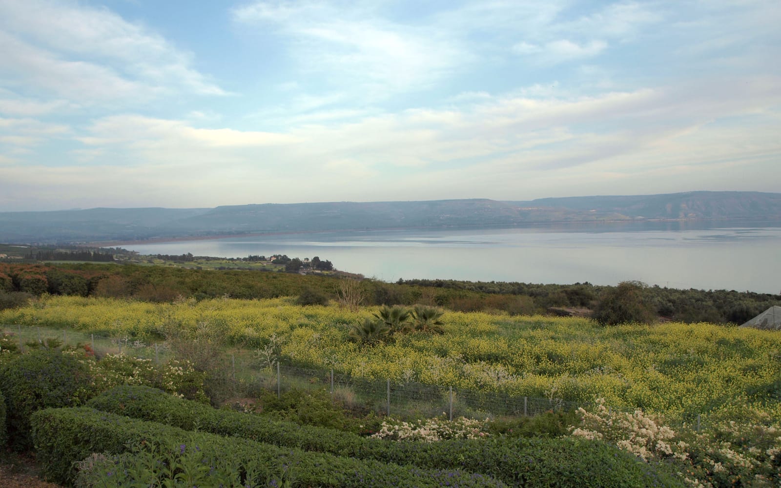
The first stop from the upper car park is the summit panorama lookout — a short 20-minute walk along the plateau to the cliff edge. The view covers the entire Sea of Galilee from the northern shore (Capernaum, Mount of Beatitudes) round to the southern outflow at Yardenit; the Golan Heights rise on the eastern shore; on clear winter days Mount Hermon’s snow caps the northern horizon. This is the strongest single Sea of Galilee panorama in the region and the destination for visitors who do not plan the cliff descent.
The Cliff Descent and Hand-Holds
The cliff descent begins about 50 metres beyond the panorama lookout. The path drops sharply through a sequence of fixed metal hand-holds and steel cables along the steepest sections (roughly 80 metres of vertical drop in the steepest stretch). The descent is straightforward for fit adult hikers with no fear of heights; reasonable upper-body strength helps. The exposed sections have clear cable handholds at every step. Visitors with vertigo, balance issues, very young children or limited mobility should not attempt the descent.
The Arbel Caves
About two-thirds of the way down the cliff, the path passes the Arbel caves — a natural rock-shelter complex that the Hasmoneans fortified into a defensive bunker system in the 1st century BCE. The caves were used as refuge during the Hasmonean revolt described by Josephus and again during the First Jewish-Roman War of 66–70 CE. The caves are signposted and can be explored briefly; bring a phone torch as some chambers are dark.
The Wadi Hamam Valley Floor
After the cliff descent, the path crosses the Wadi Hamam valley floor with its small Bedouin and Arab-Israeli villages and the access road back to the trailhead. The return loop runs back up the gentler northern slope via the Wadi Hamam path and ascends gradually back to the upper car park in about 90 minutes.
The Ancient Synagogue Remains
Near the upper car park, the partially excavated remains of an ancient synagogue (4th to 6th century CE) sit beside the path. The synagogue is a reminder that the plateau was an active Jewish village in the Roman and Byzantine periods; the architectural decoration includes carved menorah motifs visible in surviving stones.
Tours of Mount Arbel
Several Tiberias-based tour operators offer guided Mount Arbel hikes including transport to and from the trailhead, an experienced guide for the cliff descent and the cave history, and packed lunch. Independent hiking by rental car is equally practical for confident hikers.
Practical Tips
Start early in summer — temperatures on the cliff face climb above 35 degrees by 11:00 and the descent has no shade. Sturdy hiking shoes are essential; running shoes or sandals will not grip the basalt rock. Bring at least 1.5 litres of water per person and electrolyte tablets in summer. Gloves help on the cliff hand-holds though not essential. Plan the return if you do the full loop — the gentler northern path adds about 90 minutes; alternatively pre-book a taxi pickup from the Wadi Hamam side. Photography is best at sunrise and the hour before sunset.
Why Visit
Mount Arbel is the nature-and-history counterpoint to the Sea of Galilee pilgrim circuit — a single hike that combines the strongest Sea of Galilee panorama, a genuinely exciting cliff descent with millennia of continuous use, and the Hasmonean refuge caves with their 1st-century BCE military history. For travellers who want one strong outdoor day in a Galilee trip, this is the choice.
Nearby Attractions
Tiberias is fifteen minutes east for hotels, food and lake access. Magdala is twenty minutes north along the western shore for the Mary Magdalene archaeological dig. Capernaum + Mount of Beatitudes cluster on the northern shore. The Wadi Hamam villages at the base of the cliff offer Druze-influenced food and small guesthouse options for travellers who want a quieter base.