The Jerusalem Pilgrimage Road is a 600-metre limestone-paved street built some 2,000 years ago and used for roughly 90 years as the central processional route through Herodian Jerusalem — from the Pool of Siloam, where worshippers immersed before ascending, up through the valley to the Temple Mount. It was buried and forgotten when the Romans destroyed Jerusalem in 70 CE. Excavated over 13 years by the Israel Antiquities Authority and inaugurated in September 2025, it opened to public visitors in January 2026.
No comparable English travel guide to this site exists anywhere. The major travel publishers — Lonely Planet, Timeout, TripAdvisor — have not updated their Jerusalem coverage since before October 2023. This guide is the first detailed English-language visitor resource for the road.
What is the Jerusalem Pilgrimage Road?
The road has two formal names: the Jerusalem Pilgrimage Road (the official archaeological designation) and the Stepped Street (describing its physical character — wide limestone steps ascending the valley slope). Both refer to the same structure.
Age and period: the street was constructed approximately in the 1st century BCE, during the massive building programme of Herod the Great that also created the expanded Temple Mount platform and the Herodian Western Wall. It was used continuously until the Roman destruction of Jerusalem in 70 CE — approximately 80–90 years of active pilgrimage use. The stones you walk on were last walked by Second Temple-period pilgrims before the Destruction.
Physical dimensions: 600 metres long, 7.5–8 metres wide — wide enough for large crowds of pilgrims moving simultaneously uphill and downhill. The paving stones are large-format Jerusalem limestone; the street is lined on both sides by shops (tabernae) — the ancient equivalent of market stalls — where archaeologists recovered bronze weights, coins, pottery, and other evidence of commerce.
What lies beneath: a first-century drainage channel runs beneath the road’s entire length, carried in a vaulted stone tunnel. This is the same channel described in the Jewish historian Josephus’s account of the Roman siege, in which Jewish defenders hid from Roman forces. Part of the channel is open to visitors as the Herodian Drainage Channel walk.
The excavation: the Israel Antiquities Authority excavated the road from 2012 to 2025 — 13 years, beneath an active urban neighbourhood. Over 100 column drums and architectural fragments were recovered. The excavation is among the largest and most complex urban archaeological projects ever undertaken in Israel.
The inauguration: September 2025
The road was officially inaugurated on 15 September 2025 in a ceremony attended by Israeli Prime Minister Benjamin Netanyahu, United States Secretary of State Marco Rubio, and US Ambassador Mike Huckabee. The political symbolism of the ceremony was significant and widely reported — the United States administration’s presence at the inauguration was a deliberate statement.
Editorially, this guide presents the road for what it is archaeologically: a well-preserved, genuinely significant Second Temple-period street, the result of serious long-term archaeological work. The political context of the inauguration is real and worth knowing; it does not diminish the archaeological significance of what was uncovered.
Public visitor access opened in January 2026.
How is this different from Hezekiah’s Tunnel?
This is the most common confusion. The City of David complex contains several distinct archaeological features from very different periods:
| Feature | Period | What it is |
|---|
| Hezekiah’s Tunnel | 701 BCE (Iron Age) | Water channel for the Gihon Spring; you wade it |
| Gihon Spring / Bronze Age remains | 3000–1000 BCE | Original water source; ancient shafts |
| Jerusalem Pilgrimage Road | ~20 BCE–70 CE (Second Temple) | Processional street to Temple Mount |
| Pool of Siloam | 1st century BCE | Ritual immersion pool at road’s base |
| Herodian Drainage Channel | 1st century BCE | Vaulted tunnel beneath the road |
Hezekiah’s Tunnel is approximately 700 years older than the Pilgrimage Road. They are accessed via the same visitor complex but are separate experiences. Many guided City of David tours now include both — confirm with your operator which elements are included.
The Pool of Siloam: where the walk begins
The Pilgrimage Road starts at its southern end — the Pool of Siloam — and ascends northward toward the Temple Mount.
The Pool of Siloam is a large stepped ritual pool cut from bedrock, dated to approximately the 1st century BCE. It held thousands of worshippers simultaneously. Pilgrims would immerse here — a ritual bath (mikveh) — achieving the state of ritual purity required before entering the Temple precinct. The pool then refilled via the same water-management system connected to the Gihon Spring and Hezekiah’s Tunnel.
The pool appears in the Gospel of John (9:6–7) as the site where Jesus healed a man born blind, sending him to wash in the pool. For Christian pilgrims, the Pool of Siloam is thus both a Jewish Second Temple ritual site and a New Testament healing site — a dual significance that makes it relevant to multiple pilgrimage traditions.
Only a portion of the pool has been excavated; ongoing archaeological work continues to expand the visible area. The current exposed section reveals the characteristic wide, shallow Herodian steps descending to the water channel.
Walking the road
The Pilgrimage Road ascent from the Pool of Siloam to the Temple Mount approach is approximately 600 metres of wide limestone steps. Allow 45–60 minutes to walk it at an unhurried pace, reading the information panels along the route.
Physical character: the road ascends gradually through the Kidron Valley, with the valley walls rising on both sides. The wide limestone paving is well preserved — you are walking on original Herodian stone. The scale is striking: this street was built to accommodate thousands of pilgrims simultaneously during the three major Jewish pilgrim festivals (Passover/Pesach, Shavuot, and Sukkot).
What to look for along the way:
- Column drums and architectural fragments: dozens of architectural elements recovered from the street level are displayed in context along the route
- Tabernae (shops): the recessed doorways lining both sides of the street show where merchants sold to pilgrims — oil, incense, doves, food
- Coin finds: the IAA recovered coins dating from the Hasmonean period through the First Jewish Revolt (66–70 CE); the latest coins show the road was in use right up to the Destruction
- Herodian stonework quality: the quality of the construction is consistently high — Herodian builders were among the most skilled in the ancient Near East
The Herodian Drainage Channel: an optional extension takes you down into the vaulted drainage channel that runs beneath the road. This is the passage described in Josephus in which Jewish refugees attempted to escape the Roman destruction. Part of the channel connects back to the main City of David complex; it requires a torch (headlamp recommended) and an additional ticket — verify at cityofdavid.org.il.
| Detail | Information |
|---|
| Access | Via City of David National Park — enter from Maalot Ir David Street, Silwan |
| Tickets | cityofdavid.org.il (Pilgrimage Road may require add-on ticket; verify before visiting) |
| Hours | City of David complex: Sun–Thu 08:00–19:00 (summer); Fri 08:00–14:00; closed Saturday — verify at cityofdavid.org.il |
| National Parks Pass | NOT valid — City of David has separate ticketing |
| Duration | 45–60 min for the road walk alone; 3–4 hours for full complex including tunnel |
| Getting there | 5-min walk south from Dung Gate (Western Wall plaza exit) |
| Accessibility | The road surface is original ancient stone steps — not wheelchair accessible |
| Photography | Permitted throughout |
| Best time | Spring and autumn; avoid peak Passover/Sukkot crowds if sensitive to large groups |
The Silwan neighbourhood context
The City of David National Park — through which the Pilgrimage Road is accessed — sits within the Palestinian east Jerusalem neighbourhood of Silwan, home to approximately 50,000 residents. The park is managed jointly by the Israel Nature and Parks Authority (INPA) and the Elad Foundation, a right-wing Israeli organisation involved in east Jerusalem settlement expansion. This management arrangement and the inauguration ceremony’s political character are contested by Palestinian community organisations and a number of archaeologists.
For visitors: the archaeological significance of the Pilgrimage Road is real and substantial — this is 13 years of serious scientific excavation work revealing a major piece of ancient Jerusalem’s urban fabric. The political context is equally real and equally worth knowing. This guide presents both without editorialising on the wider conflict.
Combining the Pilgrimage Road with other Jerusalem sites
City of David + Hezekiah’s Tunnel + Pilgrimage Road: the full underground Jerusalem experience. Start at the visitor centre, walk Hezekiah’s Tunnel wet route, exit at the Pool of Siloam, then ascend the Pilgrimage Road. This is a half-day experience minimum (3–4 hours); budget a full morning.
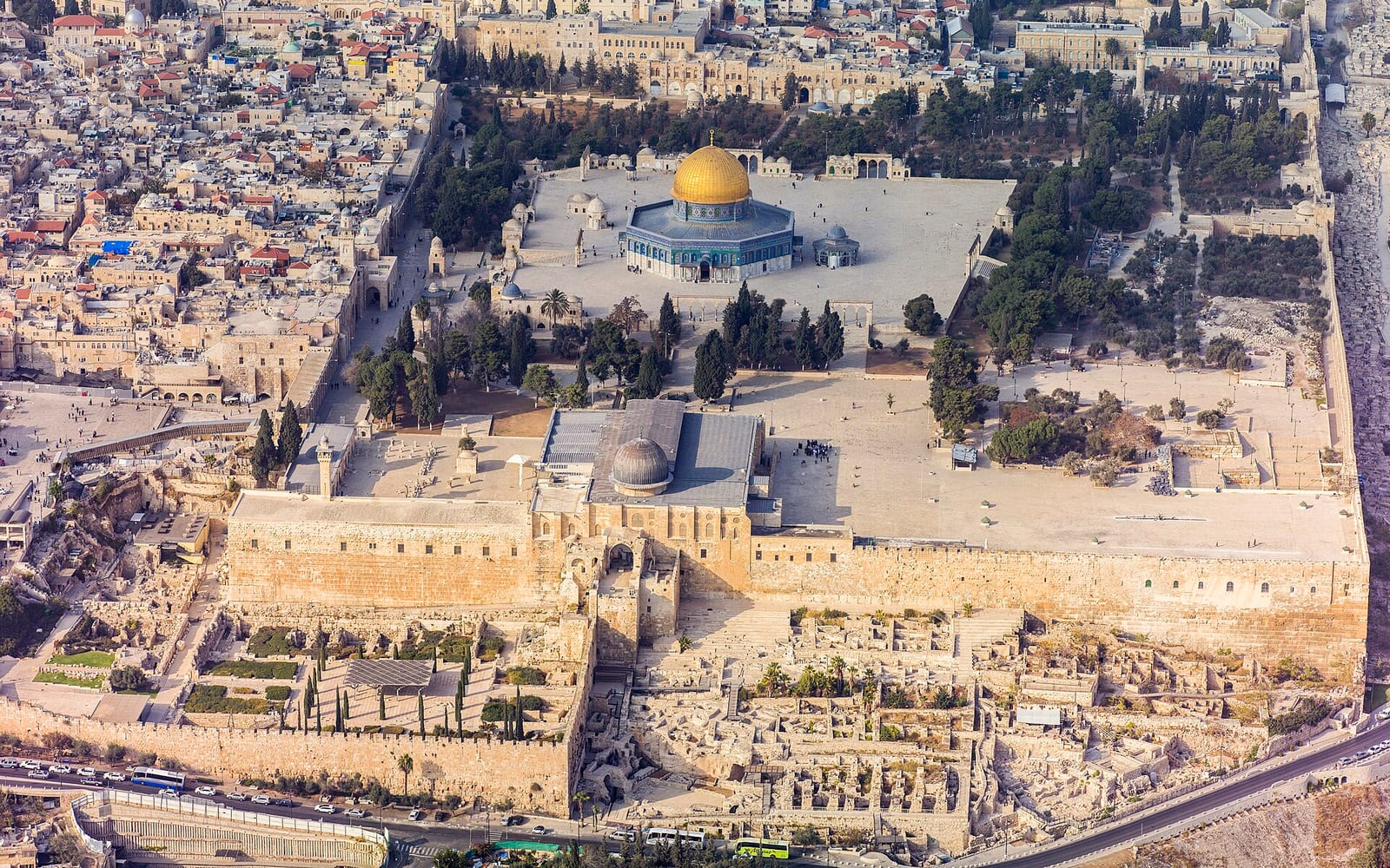
The Western Wall: 5-minute walk from Dung Gate. The Western Wall is the surviving Herodian retaining wall of the Temple Mount platform that the Pilgrimage Road originally led toward. Walking the road and then standing at the Western Wall gives a physical experience of the Second Temple-era geography that photographs cannot convey.
Western Wall Tunnels: separate booking; the underground excavation along the Herodian Western Wall on the north side of the Western Wall plaza. Combining with the City of David + Pilgrimage Road gives a complete Herodian-era Jerusalem day. See our City of David guide for the Western Wall Tunnels context.
Christian pilgrimage route: the Pool of Siloam is a Gospel of John site; the Via Dolorosa (Stations of the Cross) begins north of the Temple Mount. Combining the Pilgrimage Road with the Via Dolorosa and the Church of the Holy Sepulchre covers the key Jerusalem sites of the New Testament in sequence. See our Christian pilgrimage guide for the full itinerary.
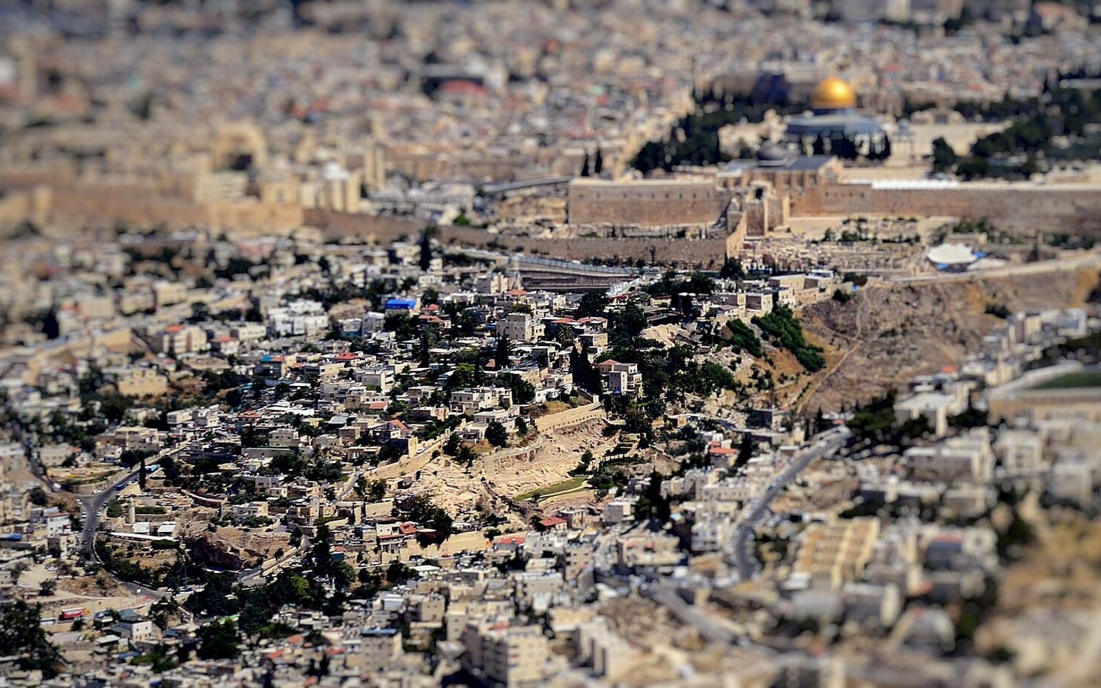
Mount of Olives: 15-minute walk across the Kidron Valley from the Pilgrimage Road exit. The panoramic view from the summit — across the Kidron Valley to the Temple Mount and the City of David ridge — makes the Second Temple-era topography immediately legible. See the Jerusalem Old City walking tour guide for a route that combines these sites.
Getting there
From the Western Wall: exit Dung Gate, turn left and walk 200 metres downhill on Maalot Ir David Street to the City of David visitor entrance. The walk takes 5 minutes.
From central Jerusalem: taxi or bus to Dung Gate (Sultan’s Pool bus stops nearby on Derech Hebron). Allow 10 minutes from the Mahane Yehuda market area by taxi; 20–25 minutes on foot from Jaffa Gate via the Jewish Quarter.
By guided tour: most licensed Jerusalem archaeological tour operators are integrating the Pilgrimage Road into their City of David itineraries from 2026 onward. A guided half-day tour is strongly recommended for first-time visitors — the stratigraphic and historical context is difficult to appreciate without explanation. Use the GetYourGuide CTA above to compare current tour options.
For holy site dress code requirements at the Western Wall and nearby Temple Mount area, see our holy sites dress code guide.
For the full Christian pilgrimage route through Jerusalem and the Galilee, see the Christian pilgrimage guide.