Tel Megiddo — known in biblical prophecy as Armageddon — is an archaeological mound that has seen more history per square metre than almost anywhere on earth. Rising 60 metres above the Jezreel Valley at the mouth of the most strategically important mountain pass in the ancient Near East, Megiddo was a Canaanite and Israelite city for more than 5,000 years. Today it is a UNESCO World Heritage Site (inscribed 2005, as part of the Biblical Tels group with Hazor and Beer-Sheba) and a national park that rewards visitors who come prepared.
For those with an interest in ancient history, biblical archaeology or the sheer physical impact of standing on ground that decided empires, Tel Megiddo offers 2–3 hours of some of the most layered archaeology in Israel.
Why Tel Megiddo matters
Twenty-six cities in one hill
The mound — the tel — is an accumulation of collapsed and rebuilt cities. Each civilisation levelled the ruins of its predecessor and built on top; over 5,000 years, the debris accumulated to a height of 21 metres above the original valley floor. Archaeologists excavating from the 1900s onwards have identified 26 distinct occupation strata from approximately 7,000 BCE to the late 6th century BCE.
The result is a compressed record of Bronze Age Canaanite city life, Egyptian imperial occupation, Israelite kingdom building and Assyrian destruction that cannot be found in any other single site in the eastern Mediterranean.
The geography of warfare
The Jezreel Valley (the biblical Valley of Megiddon / Har Megiddo) is the natural corridor between the coastal plain and the Jordan Valley — the only flat passage through the Carmel ridge from the Mediterranean to the interior. Every army moving between Egypt and Mesopotamia had to pass through or around Megiddo. This strategic fact explains the 34+ battles recorded at or near the site across 4,000 years:
- 1457 BCE: Thutmose III defeats a Canaanite coalition — the earliest recorded pitched battle in history, detailed in the Annals of Thutmose III
- 1000–900 BCE: Solomon fortifies the site; the gate structure associated with this period is one of the most debated artefacts in biblical archaeology
- 609 BCE: King Josiah of Judah is killed confronting Pharaoh Necho — an event recorded in both 2 Kings and 2 Chronicles
- 1799 CE: Napoleon defeats the Ottoman army, calling the valley “the most natural place in the world for a decisive battle”
Armageddon: the name and the theology
The word Armageddon in Revelation 16:16 is a transliteration of the Hebrew הַר מְגִדּוֹן (Har Megiddo) — the mountain/hill of Megiddo. The Book of Revelation places the final eschatological battle between good and evil here. The theological significance comes entirely from the site’s historical record: a place where, repeatedly, the fate of nations was settled. For Christian visitors the site carries this symbolic weight in addition to its archaeological interest.
What to see at Tel Megiddo
The museum and orientation model
The visit begins at the Megiddo Museum, located at the site entrance. The museum is small but well-curated, with artefacts excavated from the site including ivory carvings (the Megiddo Ivories — 14th century BCE, among the finest Canaanite art known), seal impressions, pottery assemblages and explanatory panels for each major stratum.
The essential stop is the scale model of the site in the Solomonic period — the 10th century BCE Iron Age city — which orients you to the tel’s layout before you walk it. Allow 30–45 minutes in the museum.
The Solomonic Gate and palace area
The most visited and most controversial structure on the tel is the six-chambered gate — a large, symmetrical gate complex with three guard chambers on each side, connected by a long passage. A similar gate exists at Hazor and Gezer; 1 Kings 9:15 records that Solomon rebuilt all three cities. Yigael Yadin’s identification of the gates as Solomonic in the 1960s was the dominant interpretation for decades.
Recent archaeology and redating by Israel Finkelstein and David Ussishkin has challenged this chronology, arguing the gate belongs to the Omride period (9th century BCE, the dynasty of Ahab) rather than Solomon’s. The controversy is genuinely unresolved — both sides have credentialed advocates — and the site acknowledges it in the signage. This makes the gate more interesting, not less: it sits at the centre of live academic debate about the historicity of the United Monarchy.
Adjacent to the gate is the palace area with walls preserved to 2–3 courses: the residential quarter of Megiddo’s Israelite administrative centre.
The stables or storehouses
A large open courtyard adjacent to the gate area contains rows of stone pillars and hitching posts — interpreted by earlier excavators as Solomon’s stables, and depicted as such in popular and tourist literature for decades. More recent analysis, including by the Chicago Oriental Institute excavations, suggests they are 10th–9th century storage magazines rather than stables. The INPA signage is more careful than earlier guides; both interpretations are presented.
Whatever their function, the structure gives a vivid sense of the scale of Iron Age Megiddo’s administrative infrastructure.
Ahab’s Water Tunnel
The site’s most viscerally memorable feature is the water tunnel — a 9th century BCE (Omride period) feat of engineering that brought the city’s spring water inside the city walls.
The system works as follows: a vertical shaft 35 metres deep was cut through the tel to bedrock level; a horizontal tunnel 50 metres long was cut through the rock to the spring at the base of the tel; the spring’s original ground-level exit was then blocked and concealed from attackers, so the city’s water supply was inaccessible to besieging forces. The entire system was cut by hand through limestone.
Visitors descend 66 steps into the shaft, walk the horizontal tunnel (stooping in places, cool, lit by modern fixtures), and exit at the spring end — walking around the base of the tel back to the main entrance. Allow 20–25 minutes. Wear closed-toe shoes; the floor is uneven.
The tunnel is comparable in scale and concept to Hezekiah’s Tunnel in Jerusalem (which was cut two centuries later and is much longer); Megiddo’s version is less famous but more accessible and less crowded.
The Bronze Age temples
In the lower northern quadrant of the tel is a sequence of overlapping Bronze Age temples spanning from approximately 3000 BCE to 1200 BCE — 1,800 years of continuous ritual use on the same spot. The temples range from a simple single-room shrine to an elaborate complex with a raised altar courtyard and attached storerooms.
These are the oldest structures visible to visitors at Tel Megiddo and one of the most continuous cult-site sequences known in the ancient Near East. The signage explains the stratigraphic sequence; allow 20 minutes at this section.
The Jezreel Valley panorama
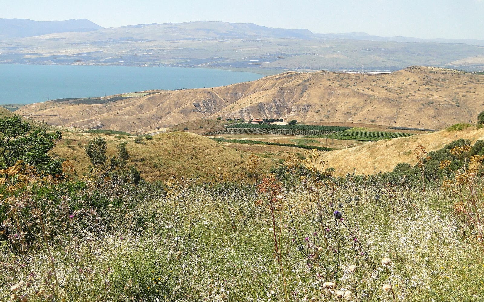
From the summit of the tel, the Jezreel Valley spreads to all horizons: the Carmel ridge to the west, the Gilboa mountains to the south-east, Mount Tabor rising from the plain to the north-east, and Nazareth on the ridge to the north. On clear days (best in winter and spring) the view extends to Mount Hermon in the far north.
This is where the strategic logic of Megiddo becomes physically legible: you can see every ancient road through the valley from this vantage point. Allow 15 minutes on the summit — longer if the weather is clear.
The Jezreel Valley circuit {#jezreel-valley-circuit}
Tel Megiddo anchors a full-day circuit of the Jezreel Valley that can be done as a day trip from Haifa, Nazareth or even Tel Aviv. The additions within 30 km of the tel:
| Site | Drive from Megiddo | Highlight | INPA Pass |
|---|
| Beit Alfa Byzantine Synagogue | 20 min east | 6th-century CE mosaic floor with zodiac wheel — the best-preserved ancient synagogue mosaic in Israel | Yes |
| Gan HaShlosha / Sachne | 35 min east | Warm spring-fed natural pools (28°C year-round), waterfalls, archaeological gardens | Yes |
| Mount Tabor | 25 min north | Transfiguration site; basilica summit views over the valley | Partly (basilica free) |
| Beit She’arim UNESCO | 45 min west | 33 rock-cut catacombs, Sanhedrin seat; UNESCO 2015 | Yes |
| Nazareth Old City | 35 min north | Annunciation Basilica, souk, Arab-Israeli restaurants | No |
A practical full-day sequence (clockwise from Haifa): Beit She’arim (morning, 90 min) → Tel Megiddo (late morning, 2–3 hrs) → Beit Alfa (early afternoon, 45 min) → Gan HaShlosha (afternoon swim, 2 hrs). Total driving: ~130 km. Start no later than 08:30 from Haifa; Gan HaShlosha pools close at 17:00 (16:00 in winter).
Getting there
Tel Megiddo is most practical by rental car or guided tour. Public transport from Haifa or Nazareth exists but requires a taxi connection from Afula.
By car from Haifa: Route 65 east from Haifa to the Megiddo/Afula junction (~35 km, 35–40 minutes). Free car park at the site.
By car from Tel Aviv: Route 2 north to Hadera, then Route 65 east (~100 km, 80–90 minutes).
By public transport: Train from Haifa Merkazit HaMifratz or Tel Aviv to Afula (40 min from Haifa, 90 min from Tel Aviv); then taxi to Tel Megiddo (~15 min, ~₪50–70). Buses from Afula run infrequently; check Egged/Kavim live schedules.
For car rental comparison, see the car rental guide for Israel.
| Detail | Info |
|---|
| Address | Tel Megiddo National Park, Route 66, near Kibbutz Megiddo |
| Opening hours | Daily 08:00–17:00 (winter to 16:00); last entry 1 hr before closing |
| Friday/holiday | Closes at 15:00; verify at parks.org.il before visiting |
| Entry fee | ~₪28 per adult (verify at parks.org.il); museum included |
| INPA Annual Pass | Covers entry — see the Israel National Parks Pass guide |
| Water tunnel | Included in entry; 66 steps down; stooping required; not recommended for severe mobility issues |
| Accessibility | Tel circuit is unpaved with uneven terrain; museum is accessible; water tunnel stairs are a barrier |
| Parking | Free at site entrance |
| Food | Café at the site entrance (seasonal hours); pack water in summer |
| Photography | Permitted throughout |
| Duration | 2–3 hours; 3–4 hrs with a guide |
See also: Beit Alfa Byzantine Synagogue · Day trips from Haifa · Israel National Parks Pass · Galilee tours compared · Jewish heritage in Israel · Christian pilgrimage guide · Car rental in Israel · Beit She’arim guide · Nazareth travel guide · Archaeological dig experiences in Israel