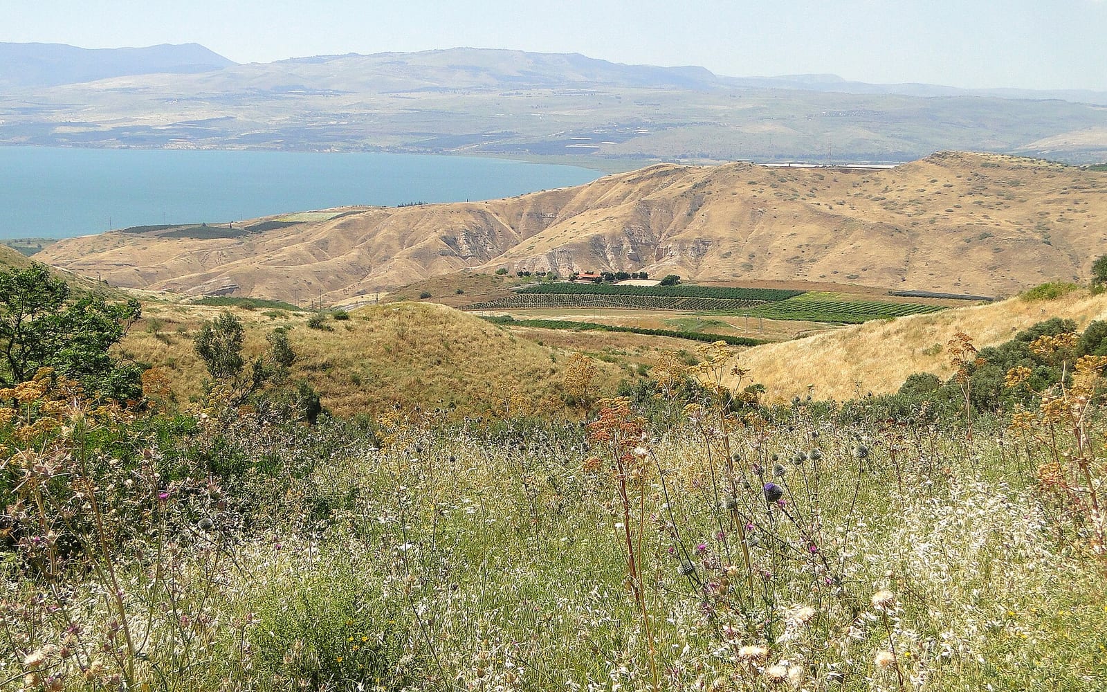
There is a single piece of land in the Jordan Valley where a Crusader castle has stood for nearly 900 years, still structurally legible — outer ward, inner keep, moat, towers — rising from a ridge 500 metres above the valley floor. Belvoir Fortress is not a ruin in the usual sense. Walk the wall circuit, cross into the inner keep, stand on the eastern rampart, and the medieval military logic of the place becomes immediately clear. The Jordan River, the Gilead hills of Jordan, the agricultural plain spreading below — all of it visible from the same vantage point that the Knights Hospitaller used to watch for Saladin’s army in the twelfth century.
Most visitors to northern Israel miss Belvoir entirely, stopping instead at Beit She’an (20 km south) or heading directly to the Sea of Galilee. That gap is what makes it worth adding to the itinerary.
A brief history
1168 — Construction. The Knights Hospitaller purchased the hilltop from the Velos family, French nobles settled in the Kingdom of Jerusalem, and built a fortress they named Belvoir — “Beautiful View” in Old French. The design was innovative for the era: a concentric castle with an outer ward of service buildings and garrison quarters surrounding a higher inner keep with its own moat and walls. This double-ring layout meant that attackers who breached the outer wall still faced a fully fortified inner citadel.
1187 — Battle of Hattin and the siege. Saladin’s decisive victory at the Battle of Hattin in July 1187 destroyed the main Crusader army near the Sea of Galilee. Most Crusader castles and cities fell within months. Belvoir was among the exceptions. Saladin besieged the fortress from late 1187, but the concentric design held: the outer ward eventually fell but the inner keep did not.
1189 — Voluntary surrender. After 18 months of siege, the Belvoir garrison surrendered in January 1189 — not from military defeat but from supply exhaustion. They negotiated safe conduct for all defenders. This is the historically accurate nuance worth knowing: Belvoir was never taken by assault. It held until the garrison chose to leave on their own terms.
1220 — Mamluk demolition. To prevent the fortress from being reused as a military base, Ayyubid and later Mamluk forces systematically dismantled sections. The result is why some areas are lower than others today — but the basic wall layout, towers, moat, and interior rooms survive to a remarkable degree. The original concentric design is fully readable.
Today. The Israel Nature and Parks Authority (INPA) manages the site as Kokhav HaYarden National Park. INPA has cleared and stabilised the ruins and established access paths. The on-site interpretation is sparse; a guidebook or an INPA audio guide, if available, adds significantly to the visit.
What to see
The outer ward. You enter through the eastern gatehouse — a vaulted passage where the original portcullis groove is still visible in the stonework. The outer ward was the garrison’s working space: stables, kitchens, storage, and service buildings. The outer wall is wide enough to walk in sections, with views over the valley opening as you move south and east around the circuit.
The inner moat and keep. A dry moat separates the outer ward from the inner keep. Cross into the keep and you are inside what was essentially a self-contained fortress within a fortress: the Hospitaller command centre, with a central courtyard, vaulted halls, storage cisterns, and the chapel and commander’s quarters. The scale is intimate rather than palatial — this was a military garrison with a specific strategic purpose, not a grand residence.
The eastern rampart viewpoint. This is the reason to make the drive. Stand on the outer ward’s eastern wall or the keep’s eastern tower and the Jordan Valley spreads below in full panorama. On clear mornings the King Abdullah Bridge over the Jordan River is visible, the Gilead hills of Jordan form the eastern horizon, and the Dead Sea corridor recedes to the south. The altitude differential is roughly 500 metres from fortress to valley floor — the effect is genuinely vertiginous.
Sunrise. The eastern exposure makes Belvoir one of Israel’s finest sunrise viewpoints. Arriving at dawn means a 05:00–05:30 start from Tiberias or Beit She’an, but the reward — the Jordan Valley catching light before the hilltop does, the Gilead hills going orange before the sky turns blue — is exceptional. Always verify opening hours at parks.org.il before an early start.
| |
|---|
| Getting there | Car via Route 90 → Route 717 junction north of Beit She’an → 8 km to site; no public bus |
| Admission | ~₪35 per adult; Israel National Parks Pass valid — verify at parks.org.il |
| Hours | Typically 08:00–17:00 winter, 08:00–19:00 summer — check parks.org.il before visiting |
| Facilities | Car park + toilets at entrance; no cafe, restaurant, or shop on site |
| Duration | 1.5–2 hours for full circuit |
| Accessibility | Uneven stone paths and steps throughout; not wheelchair accessible |
| Nearest services | Beit She’an town, 20 km south on Route 90 |
| What to bring | 1.5L+ water per person, snacks, sun hat; no shade on access paths |
Road note: The access road to the fortress has been partially paved in recent years but conditions vary. Check parks.org.il/en/reserves/kokhav-hayarden for current access status before visiting — the site is a committed drive and arriving at a closed road is a significant inconvenience.
The natural combination: Belvoir and Beit She’an
The most logical pairing is a full Jordan Valley day: Belvoir Fortress in the morning, Beit She’an National Park in the afternoon, with the two sites 20 km apart on Route 90 (approximately 20–25 minutes by car).
Beit She’an National Park preserves one of the most impressive Roman and Byzantine archaeological sites in Israel: a 7,000-seat Roman theatre (best preserved in the country), a colonnaded Byzantine cardo, floor mosaics, public baths, and the layered tel showing 18 strata of occupation from Canaanite through Ottoman. The Israel National Parks Pass is valid at Beit She’an too. The historical arc of a single day — medieval Crusader fortification in the morning, Roman urban civilisation in the afternoon — is genuinely coherent.
Add Gan HaShlosha (Sachne) for a natural swimming stop: 3 km south of Beit She’an, spring-fed pools at a constant 28°C year-round. The Parks Pass is valid here as well. A full Jordan Valley day: Belvoir early morning → Beit She’an ruins mid-morning to noon → Sachne swimming in the afternoon.
See the Beit She’an visitor guide for detailed practical information and what to expect inside the park.
Belvoir in context: Crusader fortifications in northern Israel
Belvoir is one of a sequence of Crusader fortifications across northern Israel, each with a distinct character:
- Nimrod Fortress (Golan Heights) — later Mamluk expansion of a Crusader position; dramatic basalt construction; panoramic Galilee views. See the Golan Heights guide.
- Montfort Castle (Western Galilee, Nahal Kziv canyon) — Teutonic Knights’ headquarters; partially standing in a forested canyon setting
- Akko / Acre Hospitaller compound — the largest surviving Crusader urban complex in the world; underground vaulted halls below the Ottoman city. See the Akko & Acre guide.
Belvoir is the most structurally intact as a fortification plan of this group. The concentric design is legible here in a way it is not at Montfort (too ruined) or Akko (later Ottoman rebuilding overlaid much of the medieval fabric). For anyone interested in medieval military architecture, the three sites together form a compelling sequence.
Cross-links