Israel rewards the driver. Within a single tank of fuel, a road trip can move from Mediterranean sea-cliffs to Crusader fortress ramparts to a Galilee wine valley to the world’s lowest paved road — a range that takes most countries an entire week to cross. Public transport covers the cities well; the best landscapes belong to the car.
This guide lists the seven most rewarding scenic drives in Israel, from a quick half-day loop to a two-day desert descent. Each entry has the route, highlights, what to watch out for, and links to the full destination guides for every major stop.
Before you go: compare rental prices and check pick-up timing at car-rental-israel. For Israeli road rules, tolls, parking apps and fuel, the driving in Israel guide covers everything. Unsure whether a car is worth it for your trip? The Should I rent a car in Israel? quiz gives a personalised answer in under a minute.
At a glance
1. Highway 40 — The Negev Spine {#highway-40-negev}
Distance: 80 km (Beer Sheva to Mitzpe Ramon) · Driving time: 1 h without stops · Best season: October–April
Highway 40 is Israel’s second-longest road (302 km, Beer Sheva to the Arabah Valley), and its most dramatic stretch is the first 80 km south from Beer Sheva, where Israel’s most concentrated cluster of Negev attractions lines the roadside within walking distance of each other.
Key stops:
- Sde Boker (km 38 from Beer Sheva) — David Ben-Gurion’s kibbutz home in the desert. The founding prime minister retired here and is buried in a garden overlooking the Zin Wadi; the grave and adjacent Midreshet Ben Gurion visitor complex are free to visit.
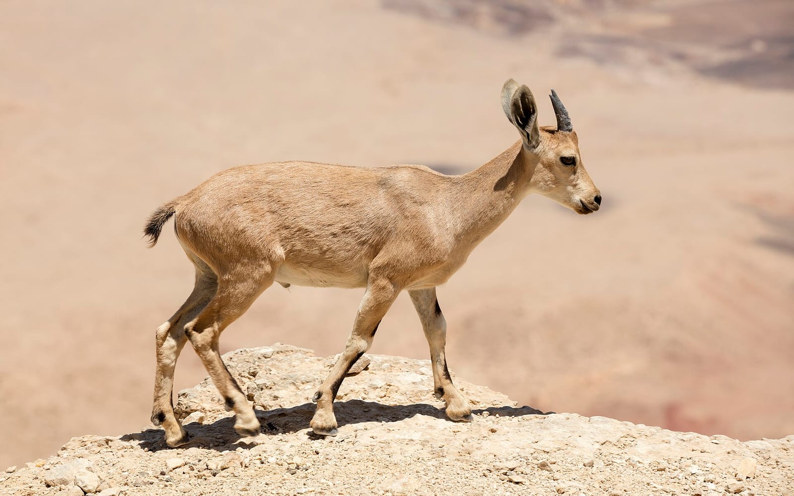
- Ein Avdat National Park (km 45) — a desert canyon oasis. The short north-entrance trail passes ancient rock-cut pools fed by a waterfall, ibex browsing the cliff face, and a canyon so narrow you walk between walls. The south-entrance trail takes 2–3 hours for the full climb; the north trail is 45 minutes return and suitable for most fitness levels.
- Avdat (Ovdat) Nabataean City (km 50) — a UNESCO Incense Route site. Spice caravans from Arabia passed through this 3rd-century BC city for 600 years. The Roman-era ruins include a bathhouse, two Byzantine churches, a colonnaded street and a reconstructed Nabataean house with a working ancient wine press. Entry is included in the Israel National Parks Pass.
- Mitzpe Ramon (km 80) — the small town sits on the rim of Makhtesh Ramon, the world’s largest erosion crater (40 km long, 2–8 km wide, 500 m deep). The Makhtesh Ramon Visitor Centre at the crater lip is free to enter; the panoramic view alone is worth the drive. Mitzpe Ramon guide →
Practical notes: Fill up at Beer Sheva before departure. The Avdat junction petrol station (Paz; at the Highway 40/Route 25 crossroads) is the last reliable station before Eilat, 155 km south. Carry 2 litres of water per person minimum; the desert is genuinely dangerous in summer — avoid this route between June and September. For off-road detours into Makhtesh Ramon and Wadi Zin, see the Mitzpe Ramon guide and the south Israel itinerary.
2. Jerusalem Hills — Route 395 {#jerusalem-hills}
Distance: 25 km (Sha’ar HaGai to Jerusalem) · Driving time: 35 min without stops · Best season: October–May
Route 1 east from Tel Aviv climbs into the Jerusalem Hills through the Sha’ar HaGai pass (the “Gate of the Valley”), where rusting hulks of the 1948 supply convoys that broke the Siege of Jerusalem have been left as monuments in the pine forest. At the top of the initial climb, turn off onto Route 395 toward Ein Kerem and Yad Vashem instead of continuing on Route 1.
The 395 winds through the Jerusalem Forest — 8,000 dunams of pine and cypress planted by the Jewish National Fund — passing the Ein Kerem valley (a village of art galleries, churches and a famous spring), Hadassah Hospital (home to the Chagall stained-glass windows), and the Yad Vashem complex on Mount Herzl before entering the city from the south-west.
This is a much more scenic approach to Jerusalem than the Route 1 motorway, and it arrives near the Israel Museum, the Knesset and the new National Library. Best in winter after rain when the forest smells of pine and the hillsides are green.
What to stop at: Ein Kerem village (30 min walk; church of St John the Baptist; spring; lunch at one of the artist-quarter cafés). Yad Vashem is on the same road — plan 2–3 hours for the memorial. Yad Vashem guide →
3. Golan Heights — Route 98 Border Road {#golan-route-98}
Distance: 70 km loop from Katzrin · Driving time: 1.5 h without stops · Best season: March–November
Route 98 is the highest paved road in Israel, tracing the basalt plateau of the Golan Heights along the Syrian border. The Golan sits at 1,000–1,200 m and feels nothing like the coastal Mediterranean; the air is cooler, the landscape volcanic, and the views are wide.
Key stops (north to south):
- Nimrod Fortress — a 13th-century Crusader-Ayyubid castle on a basalt ridge with panoramic views over the Galilee below. Entry included in the National Parks Pass.
- Banias Nature Reserve — Banias spring (ancient Caesarea Philippi, a Hellenistic sacred site) plus Israel’s highest waterfall (10 m drop) on the suspended walkway trail. Route 98 passes directly here.
- Quneitra viewpoint — the abandoned Syrian capital of the Golan is visible from an IDF observation point just off Route 98. A strange, compelling sight.
- Mount Bental — an old IDF artillery position converted into a café and observation deck. On a clear day you can see Mount Hermon to the north, the Galilee sea below and the Jezreel Valley south. Some of the best panoramic photography in Israel.
- Golan wineries — Yarden, Chateau Golan, Pelter and Assaf are all within a few kilometres of Route 98; most have visitor centres open Sunday–Friday.
Practical notes: Fill up in Katzrin before leaving. The road is fully sealed and suitable for a standard car; the Golan is safe for tourists but stay on marked roads near the northern perimeter. The Northern Israel road trip guide integrates this drive into a full 3–4 day Galilee loop.
4. Gilboa Ridge — Route 667 {#gilboa-ridge}
Distance: 18 km (ridge road, one way) · Driving time: 30 min without stops · Best season: February–May
Route 667 traces the Gilboa Ridge — the limestone escarpment above the Harod Valley — between Gan HaShelosha (Sachne) in the west and Geva in the east. It is one of Israel’s most underrated drives: a narrow ridge road that rises above the Jezreel Valley plain with views of the valley, the Sea of Galilee and the Galilee hills.
In February–March, the Gilboa Iris (Iris haynei, purple-black and unique to this mountain) blooms across the hillside in a distinctive flowering display. Katef Shaul viewpoint on the ridge is the best photography point; the iris blooms between 400 m and 600 m altitude, best reached from the Gilboa Iris Trail (a 2 km signed loop off Route 667).
In summer, the ridge offers a cool breeze above the Harod Valley heat; the drive connects naturally to Gan HaShelosha (Sachne) springs for a swim on the way home.
Combined with: Beit She’an archaeological site is at the eastern end of Route 667, 10 km from Geva. The Roman-era city excavation is one of Israel’s largest archaeological parks and worth 1.5–2 hours.
5. Carmel Mountains Forest Roads {#carmel-mountains}
Distance: 40 km (Haifa to Daliyat el-Carmel) · Driving time: 50 min without stops · Best season: October–May
The Carmel ridge rises 546 m above Haifa and is almost entirely forested — pine, oak and carob in a Mediterranean scrubland that smells of resin after rain. Several forest roads cross the ridge between the coastal suburbs and the Druze market town of Daliyat el-Carmel, and the drive through them is the most pleasant way to arrive at the village rather than coming up the main highway.
From central Haifa, Route 672 winds up through Tirat Carmel into the forest reserve. The Carmel National Park (free to enter; Israel’s oldest national park) covers the ridge; marked hiking trails branch off at multiple viewpoints, including Elijah’s Cave (Mukhraka ridge, where tradition holds that Elijah confronted the prophets of Baal — dramatic hilltop views to the Mediterranean and the Jezreel Valley).
Daliyat el-Carmel and the adjacent Isfiya are Israel’s main Druze towns on the Carmel. The market street in Daliyat sells Druze bread (pita stuffed with olive oil and za’atar), embroidery, ceramics and local honey; the Druze Heritage House museum gives context. Combined with the Druze villages Carmel guide.
6. Sea of Galilee Ridge — Route 7717 {#galilee-ridge}
Distance: 12 km (Poriah Heights to Tiberias) · Driving time: 25 min without stops · Best season: Year-round
Route 7717 descends from the Poriah Heights (forests planted by KKL-JNF) down to Tiberias on the western shore of the Sea of Galilee, and it offers one of the best lake panoramas in Israel — a wide view of the Kinneret with the Golan Heights rising on the opposite shore.
The descent itself is the experience: the road curves through eucalyptus and pine before the full lake view opens up. Arrive at dawn for extraordinary light on the flat water. The road also passes the Poriah Hospital viewpoint (a small pull-off with a bench and the widest angle) and the KKL-JNF forest trails.
Starting from: Tsfat (Safed) road — Route 90/Route 65 via Rosh Pina; turn west onto 7717 before descending to Tiberias. Also reachable from Golani Junction via Route 77 west then south.
Combined with: Tiberias city guide for the Sea of Galilee waterfront, Kinneret promenade and boat tours. The Sea of Galilee boat tour guide covers the lake experience itself.
7. Route 90 — Dead Sea Shore {#dead-sea-route-90}
Distance: 90 km (Qumran to Ein Bokek) · Driving time: 1 h without stops · Best season: October–April
Route 90 runs the full length of Israel’s eastern edge along the Jordan Rift Valley, and its Dead Sea section — from Qumran to Ein Bokek — is the most dramatic. The road runs at minus 400 metres, the lowest paved road on Earth, with the Dead Sea to the west, the Judean Desert cliffs to the east, and a visual bleakness unlike anywhere else in the country.
Key stops:
- Qumran National Park — where the Dead Sea Scrolls were found in caves visible from the site. The visitor centre has a 45-minute presentation; the cave viewpoints are free to photograph from below. Entry included in the National Parks Pass.
- Ein Gedi Nature Reserve — a desert oasis with year-round springs and waterfalls. Two separate trail systems: Wadi David (the classic 1-hour loop with David’s Waterfall and ibex sightings) and Wadi Arugot (longer, more dramatic gorge; water hiking in spring). Cross-link: water hiking Israel.
- Dead Sea beaches — Kalia Beach (northernmost, public, ₪75 entry; changing rooms, fresh-water showers, lounge chairs) is at the northern end near Qumran. Ein Bokek (southern resort strip) is at the far end of the route and has hotel beach access. Dead Sea guide →
- Salt formations — in the final stretch to Ein Bokek, white salt formations appear along the shoreline where the water has receded. Photogenic and accessible from small pull-offs.
Practical notes: Carry extra water — the Dead Sea shore is very hot from May to September. Route 90 is a standard two-lane highway with occasional slow trucks; overtake with care. Avoid the Kalia/Ein Gedi section during Passover and Sukkot when Israeli domestic traffic is extremely heavy.
Combining routes: the full Israel road trip
If you have 7 days, the Israel road trip guide strings routes 1, 3, 6 and 7 together into a clockwise national loop (Tel Aviv → coastal north → Golan → Jordan Valley → Dead Sea → Negev → back). For a tighter 3–4 day northern circuit covering routes 3 and 6, the Northern Israel road trip guide gives a day-by-day plan.
Useful links before you go: