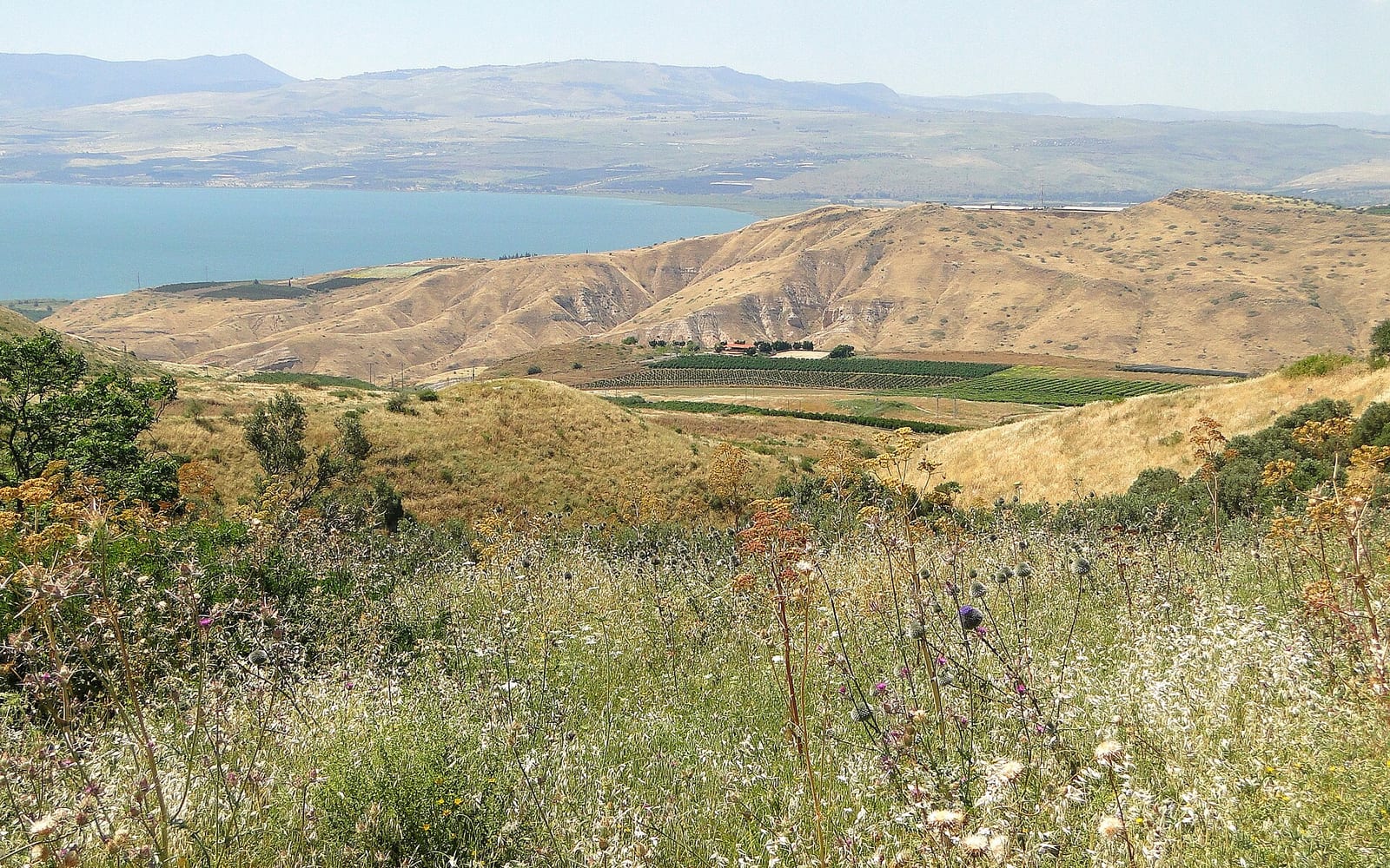
The Yam l’Yam — Hebrew for “Sea to Sea” — is Israel’s most popular multi-day walk for active tourists: an 89 km route through Upper Galilee from the Mediterranean coast near Akko to the Sea of Galilee at Capernaum, typically completed in 3 to 5 days. The trail weaves through Crusader castle ruins, Druze mountain villages, ancient forest ridges and basalt overlooks before dropping to the blue expanse of the Sea of Galilee on the final stage.
Unlike the 1,000-km Israel National Trail, the Yam l’Yam is compact enough for most travellers’ schedules — and the infrastructure of guesthouses and kibbutz hotels along the route means you carry only a daypack. At Passover week, thousands of Israeli families and hikers set out together, turning the trail into a joyful national event.
Route at a glance
| Stage | Route | Distance | Key site |
|---|
| 1 | Achziv coast → Montfort Castle | ~20 km | Montfort Crusader fortress |
| 2 | Montfort area → Beit Jan (Druze village) | ~22 km | Druze highlands, forest ridges |
| 3 | Beit Jan → Jish / Amirim | ~21 km | Ancient Gush Halav synagogue, Amirim views |
| 4 | Amirim → Arbel Cliff → Capernaum | ~26 km | Arbel panorama, Sea of Galilee shoreline |
The route runs broadly east-southeast, climbing from sea level to the Upper Galilee plateau (~850 m) before the long descent to the Sea of Galilee basin (−213 m below sea level) on Stage 4 — Israel’s most dramatic elevation change in a single trail day.
Stage 1: Achziv coast to Montfort Castle (~20 km)
The trail begins at Achziv National Park on the Mediterranean coast, 4 km north of Nahariya — a coastal site with ancient Phoenician-era ruins, sandy beaches and camping. From here the route turns east, leaving the sea immediately behind and climbing into the Western Galilee hills through forest and agricultural terrain.
The stage climaxes at Montfort Castle (Qal’at al-Qurn in Arabic), a superbly preserved 13th-century Crusader fortress crowning a wooded ridge above Nahal Kziv. Built by the Teutonic Knights in the 1220s, Montfort is the most intact Crusader castle in Israel outside Akko — and since it sits within a nature reserve with no vehicle access, it almost always has fewer visitors than its quality deserves. The ruins include a Gothic-arched hall, a round defensive tower and a chapel; views from the battlements extend from the Mediterranean to the Galilee hills. Plan 45–60 minutes for a proper look.
Overnight at Stage 1: Camping at Achziv National Park (start point); alternatively, kibbutz guesthouses in the Nahariya / Ma’alot area at the mid-point of the stage, reached by shuttle or taxi if you prefer a bed to a tent. Book ahead for Passover.
Stage 2: Montfort area to Beit Jan (~22 km)
The longest climb of the walk. The trail ascends from the Montfort/Nahal Kziv valley through mixed oak and pine forest onto the Upper Galilee plateau — the highest terrain on the Yam l’Yam, with the route touching elevations around 850–900 m near Moshav Goren and the Shtula area.
The stage ends in Beit Jan, a Druze village perched on the southwestern slopes of Mount Meron. Druze hospitality is a highlight of the Yam l’Yam: guesthouses in Beit Jan and the surrounding Druze villages offer home-cooked food (mezze, flatbread, stuffed vine leaves, strong sweet coffee) and beds in family homes. The Druze community is friendly to hikers; modest dress is appreciated in the village. Note that Druze villages are open and welcoming on the Jewish Shabbat — a practical advantage for Passover-week hikers whose Thursday stage ends here.
Overnight at Stage 2: Beit Jan Druze guesthouses (small number — book well ahead for Passover week); Kibbutz Shtula or Goren (slightly off-trail, often available on shorter notice).
Stage 3: Beit Jan to Jish and Amirim (~21 km)
The plateau traverse. The trail crosses the heart of the Upper Galilee through forest and pasturelands, passing several historically significant sites before the first real descent toward the Galilee rift.
Jish (Gush Halav in Hebrew, al-Jish in Arabic) is a Maronite Christian Arab village on the site of the ancient Jewish city of Gush Halav — one of the last strongholds to fall to Rome in the Great Revolt. The ruins of a Byzantine-era synagogue are visible at the edge of the village, and the Church of Saints Cosmas and Damian maintains a small museum of local antiquities. A brief detour into the village for lunch (several small restaurants) is worthwhile.
The stage climbs from Jish to end at Amirim, a pioneering vegetarian moshav founded in 1958 in the Upper Galilee forest. Amirim sits at roughly 850 m elevation and has panoramic views south toward the Sea of Galilee — a dramatic preview of Stage 4. The moshav has a cluster of guesthouses and small B&Bs, most vegetarian or vegan, making it one of the most comfortable overnight stops on the trail. Book 2–3 months ahead for Passover week; Amirim fills before any other stage endpoint.
Overnight at Stage 3: Amirim moshav guesthouses (multiple options; advance booking essential). A good alternative if Amirim is full: Moshav Kerem Ben Zimra, a short drive away, or the town of Karmiel (15 km south by road — taxi needed).
Stage 4: Amirim to Arbel Cliff and Capernaum (~26 km)
The most dramatic stage and the longest. The trail drops nearly 1,000 m from the Galilee heights to the Sea of Galilee shoreline — a sustained descent through forest and basalt terrain that rewards the effort with an extraordinary final arrival.
The key viewpoint is Mount Arbel (Har Arbel), a flat-topped cliff that rises abruptly from the western shore of the Sea of Galilee. The summit looks out over the entire lake — from the Golan Heights ridgeline on the east to the Jordan Valley on the south and the Galilee hills on the west. On clear mornings the view extends to the Hermon massif on the Syrian border. The cliff face below the summit has ancient Jewish refuge caves (dating to the Hasmonean period) carved into the basalt; there is an iron-rung assisted descent route if you want the closest look at them, though the main trail contours around. Allow an hour on the summit.
From Arbel the trail descends through Moshav Arbel and the biblical site of Magdala toward the Sea of Galilee shore. The final kilometres follow the northern lakeshore to Capernaum — “his own city” according to Matthew 4:13, the base of Jesus’s Galilean ministry. Even for non-religious walkers, arriving at the Sea of Galilee on foot after 89 km of walking has an unambiguous emotional register.
Overnight after Stage 4: Tiberias is the nearest city with full accommodation — 12 km south of Capernaum by bus or taxi. See the Tiberias hotel guide for options across all budgets. Alternatively, several guesthouses in the Ginosar area (3 km south of Capernaum, on the lake) are quieter and more atmospheric.
Getting to the trailhead and home
To the Achziv start: Train from Tel Aviv or Haifa to Nahariya (about 90 min from TLV Central, 40 min from Haifa Merkavit); the trailhead at Achziv National Park is 4 km north of Nahariya by taxi or bicycle. No public bus covers the last stretch reliably — allow for a short taxi or rideshare.
From the Capernaum finish: Bus or taxi to Tiberias (12 km, ~15 min by taxi). From Tiberias, trains to Tel Aviv or Haifa depart from Tiberias station (Israel Railways); journey is ~2 hours to Tel Aviv with a change at Haifa.
The two-trailhead puzzle: Since start and end are different cities, most self-guided hikers either (a) use a rental car left at the Tiberias end and taxi to Achziv; (b) travel by train to both ends independently; or (c) join an organised guided walk where transport is arranged. See the car rental CTA above for rates from Nahariya and Haifa.
Accommodation summary by stage
| Stage end | Options | Notes |
|---|
| Achziv / Nahariya | Achziv campsite (INPA); Nahariya hotels | Campsite best in spring; Nahariya has mid-range hotels |
| Beit Jan / Shtula | Druze family guesthouses; Kibbutz Shtula | Very limited beds — Passover book 3+ months ahead |
| Amirim / Jish | Amirim moshav B&Bs (vegetarian); Karmiel (taxi) | Amirim fills first — book immediately after Beit Jan |
| Capernaum / Tiberias | Tiberias hotels; Ginosar kibbutz (lakefront) | Tiberias has the widest choice; Ginosar more atmospheric |
Distance and time: ~89 km over 4 stages; 3–5 days for most hikers (fit hikers combining stages can do it in 3; a relaxed pace exploring off-trail sites takes 5).
Difficulty: Moderate to strenuous. Elevation gain per day ranges 400–900 m; no technical sections but good footwear and basic navigation competence required.
Trail marking: Orange-white-blue blazes (KKL/JNF standard). Download the Israel Hiking Map or AllTrails GPS track as backup — forest junctions can be ambiguous, especially on Stage 2.
Best season: November–April. Passover week (March–April) is busiest. Avoid July–September: heat and ticks.
Water: Carry 3 litres between villages; springs flow reliably in winter and spring but cannot be depended upon in summer. Druze and Arab villages (Beit Jan, Jish, Gush Halav) have shops open on Shabbat.
Mobile signal: Adequate throughout — Waze and GPS apps work on all stages.
Safety notes: Some forest sections cross land adjacent to military training zones — stay on the marked trail and heed any posted INPA or IDF signs. Do not hike a wadi section (there are a few on Stage 4) during or after heavy rainfall upstream — flash floods are a genuine risk in winter. Tell someone your plan and expected return on each stage.
Combining with wider Galilee travel
The Yam l’Yam sits naturally within a broader Galilee and Upper Galilee trip. From Tiberias (the finish) you can extend to a Sea of Galilee day, continue north to the Golan Heights, or make the short drive to the Jesus Trail starting point in Nazareth. Both long trails share overlapping terrain at Mount Arbel — hikers who have done the Jesus Trail often say the Yam l’Yam’s Arbel view hits differently on a second visit, arriving from the west rather than the east.
From Akko at the start, the Akko travel guide covers the UNESCO Crusader underground, harbour and Al-Jazzar Mosque — a natural day-before exploration before setting out on the trail the following morning.
The hiking in Israel hub covers the Israel National Trail, Jerusalem Trail and day-hike options across all regions.
The Passover week walk
Each spring, the Yam l’Yam becomes a national event. Thousands of Israeli families, hiking clubs and school groups set out simultaneously, creating an atmosphere more akin to a community festival than a remote wilderness experience. Guesthouses fill; families carry folding chairs and gas stoves; the Beit Jan Druze families host more guests than any other time of year. If you want solitude and challenge, walk November or February. If you want to experience the trail as Israelis actually celebrate it — chaotic, joyful, crowded with strangers sharing pita bread at rest stops — Passover week is the right time.
Passover 2027 falls in mid-April; the main hiking week runs the intermediate days (chol hamoed), typically Tuesday through Friday.