The Golan Heights is Israel’s premier hiking region — a basalt plateau rising 600–1,200 metres above the Sea of Galilee and the Jordan Valley, laced with perennial streams that carve canyons through the ancient volcanic rock. The trails here combine geology found nowhere else in the country with reliable water, abundant wildlife, and a quality of solitude that the busiest Galilee and Negev sites rarely match.
This guide covers the main hiking circuits of the Golan: Yehudiya Forest Nature Reserve (the region’s biggest trail system), Nahal Meshushim and the Hexagon Pool, the Gamla circuit, and the Golan section of the Israel National Trail. It pairs with the Gamla Nature Reserve guide (which goes into detail on the archaeological ruins and vulture colony) and the Golan Heights guide (wineries, Druze villages, Mount Bental, and the full regional overview).
Yehudiya Forest Nature Reserve
The Yehudiya Forest Nature Reserve is the largest nature reserve in the Golan and the busiest hiking area on the plateau. It covers roughly 65,000 dunams of basalt forest, canyon, and stream — the core of the Golan’s hiking infrastructure. Three main circuits of varying difficulty depart from the trailhead on Road 87, east of Katzrin.
Yehudiya Loop (14 km, hard)
The Yehudiya Loop is the most popular full-day Golan hike. The trail descends into the Yehudiya canyon, follows the stream through dramatic basalt gorges, and climbs back out via the upper plateau — a circuit of roughly 14 km with significant elevation change (over 350 m total descent and ascent). Most experienced hikers complete it in 5–7 hours.
The canyon section includes multiple stream crossings and sections where you wade knee-deep. Water shoes or trail shoes that can get wet are essential. The canyon walls — volcanic basalt columns formed as ancient lava cooled — rise sheer on both sides; the light in the late morning is striking.
Season: Best from March to May (full stream, comfortable temperatures) and October. Feasible in summer with an early 6 am start; avoid midday in July–August.
Zavitan Canyon Loop (5 km, moderate)
The Zavitan Loop is the recommended introduction to Golan hiking — a 5 km circuit into the Zavitan Canyon, a narrower and somewhat less dramatic gorge than the Yehudiya main canyon, but quieter and easier to navigate. Total hiking time is 2–3 hours. The Zavitan stream typically runs from November through May; the canyon floor can be dry in late summer.
The path passes through a narrow slot section where the basalt walls close within arm’s reach — one of the Golan’s most photogenic passages, and cool even on warm days.
Practical details — Yehudiya
| |
|---|
| Trailhead | Off Road 87, east of Katzrin (INPA signs) |
| INPA Pass | Valid for all Yehudiya trails |
| Facilities | Car park, toilets; no café on trail |
| Public transport | None — car or guided tour required |
| From Katzrin | 10 km east on Road 87 |
| From Tiberias | 50 km (approx. 45–55 min) |
| What to bring | Water shoes, 2–3 L water, sun hat, trail shoes |
Nahal Meshushim and the Hexagon Pool
Nahal Meshushim — the name means “hexagons” — is a canyon carved through one of the Golan’s most geologically remarkable features: a series of near-perfect hexagonal basalt columns created as ancient lava cooled at a uniform rate and contracted into six-sided prisms. The canyon walls expose cross-sections of these columns; in places the basalt floor of the stream looks like a tiled floor laid by a perfectionist.
The trail runs approximately 7 km from the trailhead to the Hexagon Pool (Breichat HaMeshushim) and back — a broad natural swimming hole where the stream opens into a deep pool surrounded by the characteristic hexagonal-column cliffs. The pool temperature in spring is bracing (around 14–18°C); by late summer it warms to 22–24°C and the crowds arrive.
Visiting the Hexagon Pool
Season: The pools are deepest and clearest from March through June. In summer, the pool is warm enough for swimming but visitor numbers surge — arrive early on weekdays or book INPA day permits in advance if required (check inpa.org.il for the current permit system, which has changed in recent seasons to manage peak-weekend congestion).
Getting there: The Meshushim trailhead is off Road 98 in the southern Golan. A rental car is essentially required — there is no bus service. From the car park, the trail descends to the canyon via a marked path (red-and-white blazes); allow 45 minutes each way at a comfortable pace.
What to wear: Water shoes are essential — the hexagonal basalt underfoot is beautiful but uneven. The stream requires multiple crossings; expect to wade calf-deep for much of the lower canyon section. Bring a dry bag for phone and keys.
Gamla Nature Reserve (hiking circuit)
The Gamla circuit (5 km) combines the most dramatic archaeology in the Golan — an ancient Jewish city destroyed by Rome in 67 CE — with one of Israel’s largest Griffon vulture colonies and a 51-metre waterfall. The full loop takes 2.5–3.5 hours.
This trail is covered in detail in the Gamla Nature Reserve guide, which has the full archaeological context, vulture-watching tips, and practical logistics. A brief summary:
- The descent to the ruins is steep and rocky; solid hiking shoes are required.
- The vulture observation platform midway around the circuit puts you within 100–200 metres of active Griffon vulture nesting ledges — among the most accessible large-raptor viewing spots in the Middle East.
- The Gamla waterfall (51 m) is at its most dramatic from December through April; flow may reduce significantly by midsummer.
- INPA Pass is valid; car required (no bus service).
Banias Nature Reserve
Banias Nature Reserve anchors the northern Golan and is the most visited site on the plateau. Its main draw is a combination of a perennial spring, a dramatic waterfall, and the ruins of the ancient city of Caesarea Philippi — where Herod the Great’s son Philip built a city around the shrine of the Greek god Pan.
Banias Falls Trail
The primary hiking circuit leads from the Banias Spring (a rare year-round freshwater source, fed by snowmelt from Mount Hermon) past the temples of Pan and the Crusader-era bridge to the Banias Falls — at roughly 10 metres, one of the tallest waterfalls in Israel and usually the most powerful, since the Hermon snowmelt keeps the Hermon Stream flowing even in dry summers.
The falls circuit is approximately 4.7 km (round trip) and takes 1.5–2 hours. The path is well-maintained and suitable for most fitness levels, though sections near the falls are rocky. You can continue upstream from the spring for a shorter 1 km walk to view the Pan shrine ruins.
Nimrod Fortress
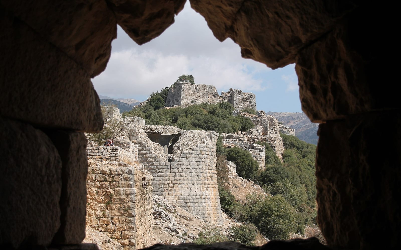
A kilometre above Banias, Nimrod Fortress (Qal’at Nimrod) is a Crusader-era castle occupying a volcanic ridge above the Hermon foothills — one of the best-preserved Islamic-era fortifications in the Levant. The INPA path through the fortress takes 1–2 hours and involves some scrambling on the upper walls. A combined Banias + Nimrod day is long but exceptionally rewarding.
The Israel National Trail — Golan Section
The Israel National Trail (Shvil Yisrael, marked red-white-red) crosses the entire Golan plateau and is walkable as a 4–5 day section hike. The Golan segment of the trail runs from the southern edge of the plateau (near Hamat Gader) northward through the heart of the reserve system:
- Day 1–2 (south Golan): Hamat Gader hot springs → Gamla → Yehudiya; basalt plateau with canyon descents.
- Day 2–3 (central Golan): Yehudiya → Katzrin → Meshushim; rolling plateau, basalt farmland, stream canyons.
- Day 3–4 (north Golan): Meshushim → Mount Bental → Banias; volcanic crater and panoramic ceasefire-line viewpoints.
- Day 4–5 (far north): Banias → Nimrod Fortress → Dan → Snir Nature Reserve; forest and springs approaching the Upper Jordan.
The Quneitra Viewpoint, on the Golan section of the trail, looks across the 1974 buffer zone toward the deserted city of Quneitra in Syria — a sobering and historically significant stop. Stay on the marked path and follow posted instructions at the military observation point.
The Israel National Trail hiking guide covers logistics for planning a section hike, including the trail-angel network and per-section water caches.
Seasonal guide
| Season | Conditions | What’s best |
|---|
| Spring (Mar–May) | 10–22°C; streams running full; wildflowers | Everything — peak season for all trails |
| Summer (Jun–Aug) | 25–35°C plateau; busy at pools | Early-morning starts; Hexagon Pool swimming |
| Autumn (Sep–Nov) | 14–26°C; trails quieter post-summer | Excellent conditions; foliage colour in late Oct |
| Winter (Dec–Feb) | 4–15°C; possible snow near Hermon | Gamla waterfall + Banias at full power; avoid far-north trails in snowfall |
Spring wildflowers on the basalt plateau — including the striking purple Golan iris (Iris haynei), endemic to the area — are one of the Golan’s most distinctive sights and peak from late February through April.
Getting there and logistics
From Tel Aviv: 2.5–3 hours via Highway 6 North and then Route 87 or Route 98 into the Golan plateau. A rental car is the practical option for reaching most trailheads independently.
From Tiberias: 45–70 minutes depending on destination. Tiberias is the nearest base with multiple accommodation options and easy car hire access.
Public transport: Egged runs buses to Katzrin (the Golan’s main town) from Tiberias; from Katzrin you would need a taxi or a car to reach individual trailheads. Banias has limited bus connections from Kiryat Shmona. For most visitors, a rental car or guided tour is more practical.
Guided tours: Day tours from Tel Aviv and Haifa typically combine two or three Golan sites — Gamla or Banias, Mount Bental, and a Golan winery visit — in a single day. These are a good option if you don’t want to navigate independently or if driving on Israeli roads is unfamiliar. See the Golan Heights guide for an overview of the full plateau.
Safety reminders:
- Stay on marked trails — the Golan has unexploded ordnance off marked paths near historical ceasefire areas; warning signs are posted clearly.
- Carry more water than you expect to need, particularly on the Yehudiya and Meshushim circuits where the canyon bottom gives a false impression of coolness.
- Flash-flood risk in canyon trails: check weather forecasts for the entire upstream watershed at ims.gov.il, not just local conditions.
- Inform someone of your hiking plan and expected return time for longer circuits.
The hiking in Israel guide has broader context on Israel’s trail network, gear, and safety. For stream and pool swimming specifically, the water hiking guide covers sites across the country including some Golan options alongside the Galilee and Dead Sea corridor alternatives.