The Jerusalem Trail (Shvil Yerushalayim, שביל ירושלים) is a 42km waymarked loop that fully encircles Jerusalem — the only circular trail of its kind around an Israeli city. It passes through a layered sequence of landscapes that mirrors the city’s history: pine-forested western hills that shelter Ein Kerem’s ancient village, a southern ridge with views into the Judean hills toward Bethlehem, the eastern escarpment of the Mount of Olives above the Kidron Valley, and northern urban quarters where the city spills toward Ramallah. Most visitors hike it in four separate day segments; experienced walkers combine two segments per day to finish in two days. Either way, the trail reveals a Jerusalem most visitors never see from inside the Old City walls.
The four segments at a glance
| Segment | Route | Distance | Ascent | Difficulty |
|---|
| 1 – West | Yad Vashem → Ein Kerem → Ora village | ~10km | ~350m | Easy–Moderate |
| 2 – South | Ora → Har Gilo → Ramat Rachel | ~11km | ~400m | Moderate |
| 3 – East | Ramat Rachel → Abu Dis ridge → Augusta Victoria | ~11km | ~300m | Moderate |
| 4 – North | Augusta Victoria → Ammunition Hill → Shuafat → Givat Hamivtar | ~10km | ~200m | Easy–Moderate |
Distances and ascent figures are estimates. Check hike-israel.com for current conditions and any trail rerouting.
Segment 1: Yad Vashem to Ein Kerem to Ora (Western Hills)
The western segment is the most forested and the gentlest introduction to the trail. It begins at the Yad Vashem Holocaust Memorial complex on Mount Herzl’s western shoulder, descends through the Avenue of the Righteous Among the Nations, and drops into the valley of Ein Kerem — a stone-built village of Byzantine churches and Ottoman-era houses that somehow survived modern Jerusalem’s expansion almost intact. John the Baptist was born here according to tradition; the Franciscan Church of the Visitation and the Church of St John the Baptist are both on the village’s terraced lanes.
From Ein Kerem, the trail climbs west through Jerusalem Forest — planted eucalyptus and pine with stone-wall terraces beneath — before emerging at the agricultural settlement of Ora. The forest walking is shaded and quiet; early morning departures often encounter deer and foxes in this section. The trail blazes (green-white-blue) follow a mix of footpaths, old tracks and brief road crossings.
Trailhead access: Bus 23/24/27 from Jerusalem Central Bus Station to the Yad Vashem stop, or a short ride from the light rail Yad Vashem station. Many hikers visit Yad Vashem first and begin the hike on the same day — the trailhead is immediately adjacent to the memorial complex.
Segment 2: Ora to Har Gilo to Ramat Rachel (Southern Ridge)
The southern segment follows the ridge above Jerusalem’s southwestern edge with some of the widest views on the trail. From Ora the route climbs to the Har Gilo ridge — the highest point on the trail at around 900m — with unbroken panoramas across the terraced Judean hills toward Bethlehem and Beit Jala. On a clear day (October–April) the Dead Sea is visible to the east.
The ridge walk descends gradually to Kibbutz Ramat Rachel, a working kibbutz on Jerusalem’s southern outskirts that has operated continuously since the 1920s, surviving a famous battle during the 1948 War of Independence. The kibbutz has a small museum, a café and guest accommodation — a useful overnight stop for walkers doing the southern segments over two days.
Note on the security barrier: This segment runs close to but does not cross the separation barrier. Trail blazes stay clearly on the Israeli/East Jerusalem side; follow the marked route and do not stray from it in this section.
Segment 3: Ramat Rachel to Abu Dis to Augusta Victoria (Eastern Escarpment)
The eastern segment is the trail’s most dramatic geographically. From Ramat Rachel it climbs north through the Abu Dis ridge — a sharp escarpment with the Judean Desert dropping precipitously to the east, the Kidron Valley below, and the Old City visible across the valley. The Mount of Olives skyline (the Russian Orthodox Church of the Ascension tower and the Seven Arches Hotel) is a constant reference point.
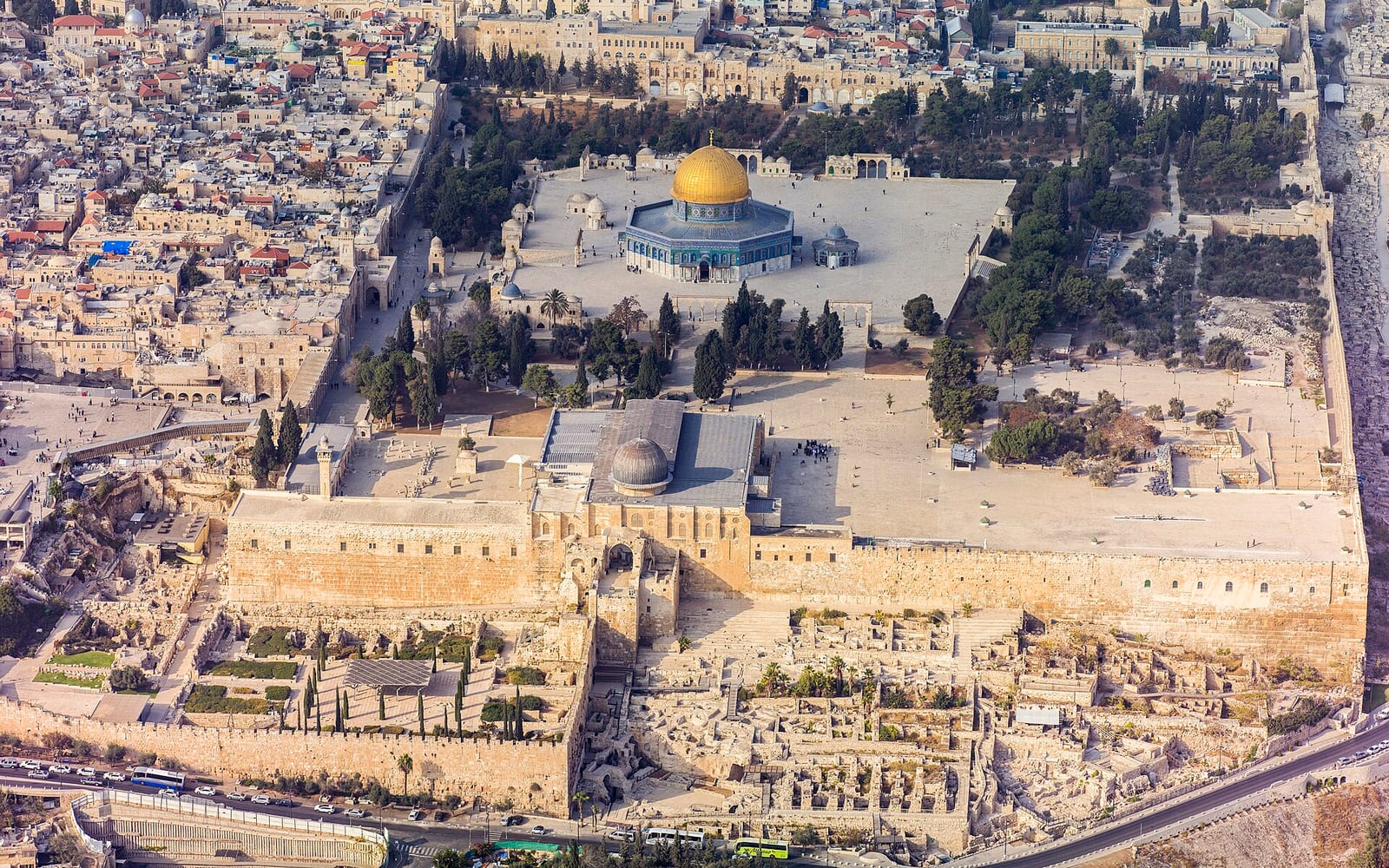
The segment ends at Augusta Victoria — the early-20th-century German Hospice and Hospital complex on the crest of the Mount of Olives ridge. The complex is open to visitors; the tower provides a fine panorama over the city. The Garden of Gethsemane, the Dome of the Rock, and the Western Wall plaza are all visible from the ridge path — a perspective that makes the city’s compressed geography suddenly legible.
Segment 4: Augusta Victoria to Ammunition Hill to Givat Hamivtar (Northern Arc)
The northern segment is the most urban, threading through built Jerusalem’s northern quarters. From Augusta Victoria it descends to the Mount Scopus ridge (Hebrew University and Hadassah Hospital), passes through the mixed neighbourhood of Shuafat, and finishes at Givat Hamivtar near the neighbourhood of Ammunition Hill.
Ammunition Hill (Givat HaTachmoshet) was the site of one of the most intense battles of the 1967 Six-Day War; it is now a preserved memorial site with original trenches and a museum. The battle for the hill gave Israel control of the northern route into the Old City. It is a sobering and historically dense endpoint to the trail loop — most walkers descend to the Ammunition Hill light rail station after the visit. See the full Ammunition Hill visitor guide for history, trench layout, museum details and logistics.
Trail markings and navigation
The Jerusalem Trail uses the standard Israeli blaze system: alternating green, white and blue stripes painted at head height on rocks, walls, fence posts and kerbs at roughly 100m intervals. The system is the same used on the Israel National Trail (red-white-blue) and the Jesus Trail (blue). In forest sections, blazes appear on trees and rocks; in urban sections, look for them on walls and kerb stones.
A free GPX track is available via the Wikiloc Jerusalem Trail listings and the AllTrails entry for “Shvil Yerushalayim.” The SPNI (Kirya Shtiebel, Jerusalem) sells the printed 1:50,000 map. Carry a downloaded GPX as backup in the eastern and northern segments, where urban rerouting is most frequent.
When to hike
Best: March–May (wildflower season, 14–22°C); October–November (post-summer cool, long daylight).
Acceptable: December–February (cold 5–12°C, possible rain or frost; forest sections muddy; dramatic light and occasionally snow on the western hills).
Difficult: July–August (30–35°C on exposed ridge sections; start before 07:00, finish by 12:00; carry at least 3 litres per segment).
The Jerusalem area sits at 750–900m elevation, so temperatures run 4–6°C cooler than Tel Aviv or the Jordan Valley at the same time of year. Sukkot (October) and Passover (April) weeks see the trail at its busiest.
Water and supplies
Water is not reliably available on trail in the western and southern segments — carry 2–3 litres per person per segment. Ein Kerem village (Segment 1) has cafés and a small convenience store; Kibbutz Ramat Rachel (Segment 2 end) has a café. Augusta Victoria (Segment 3 end) has a small hospice café. The northern segment passes through urban areas with shops.
No overnight camping shelters exist on the trail — accommodation means either basing in Jerusalem city centre and day-hiking each segment, or staying at Kibbutz Ramat Rachel guesthouse for the southern transition.
Connecting to broader Jerusalem
The Jerusalem Trail is one of four main hiking circuits available from Jerusalem. The Israel National Trail passes through the city’s eastern corridor, entering from the south via the Judean hills. Ein Kerem village — the western segment’s midpoint — is a full half-day destination in itself, with four churches, a village square and artist studios open to visitors; see the Ein Kerem guide for the full picture.
Yad Vashem — the trail’s western segment starting point — warrants a half-day of its own before or after the hike; visitor allocation tickets are required. Ammunition Hill (the northern segment terminus) requires about 90 minutes for the museum and trench walk.
For broader Jerusalem trip planning: the Jerusalem region guide covers all the major sites. For the full hiking context across Israel: Hiking in Israel covers the National Trail, the Jesus Trail and day-hike planning.