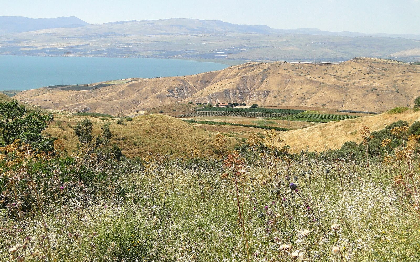
The Jesus Trail is one of the most compelling walks in Israel: a 65 km pilgrimage route through the Galilee hills connecting Nazareth — where Jesus grew up — to Capernaum on the western shore of the Sea of Galilee, the town Jesus made his ministry base. Unlike the congested holy sites of Jerusalem, this walk moves through open countryside, Arab-Israeli villages and forested ridges, arriving at each biblical location on foot as the first disciples would have.
Most hikers complete the trail in 3 to 4 days, carrying a daypack and sleeping in guesthouses or the informal “trail angel” network of local families who host walkers along the route. The trail is waymarked, well documented, and open to self-guided walkers with no specialist experience required — or to guided groups who want the biblical narrative unpacked at each site.
The route at a glance
| Stage | Route | Distance | Key site |
|---|
| 1 | Nazareth → Cana (Kafr Kanna) → Shibli | ~22 km | Wedding Church of Cana |
| 2 | Shibli → Horns of Hattin → Arbel | ~14 km | Horns of Hattin, Mount Arbel viewpoint |
| 3 | Arbel → Magdala → Ginosar | ~15 km | Magdala excavation, Sea of Galilee coast |
| 4 | Ginosar → Tabgha → Capernaum | ~14 km | Tabgha, Mount of Beatitudes, Capernaum |
The route runs broadly northeast from Nazareth, crossing the Galilee hills before descending to the lakeside in Stage 3 and finishing on the northern shore of the Sea of Galilee.
Stage 1: Nazareth to Shibli (~22 km)
The trail begins at the Basilica of the Annunciation in central Nazareth — the largest church in the Middle East, built over the cave traditionally identified as Mary’s home. Allow at least an hour at the Basilica before setting off: the international art panels in the outer courtyard (nations of the world depicting the Annunciation in their own visual style) are unexpectedly moving. The nearby Church of St. Joseph is believed to stand over the workshop of Joseph; the ancient cistern beneath is accessible.
The trail climbs out of Nazareth through the upper city and into agricultural terraces, heading northeast toward Cana of Galilee — the village where Jesus performed his first miracle, turning water into wine (John 2:1–11). The modern town of Kafr Kanna has two churches commemorating the site: the Franciscan Wedding Church and the Greek Orthodox Church nearby. Both claim the ancient stone water jars; both are worth a brief visit. A short road walk through the village centre leads back to the trail.
From Cana the path continues across open farmland and olive groves to the Bedouin village of Shibli at the foot of Mount Tabor. Shibli is the main Stage 1 overnight: trail-angel families here have hosted hikers for years. Book ahead — there are only a handful of beds, and it fills up.
Practical notes: Start early from Nazareth (7am is ideal) to give time at the Basilica before the day warms up. The road stretch through Kafr Kanna is the least scenic part of the trail; most walkers push through it quickly.
Stage 2: Shibli to Arbel (~14 km)
The shortest stage by distance but the most historically dramatic. The trail rises from Shibli toward the Horns of Hattin (Qarnei Hittin in Hebrew) — the twin-peaked volcanic crater where, on 4 July 1187, Saladin routed the Crusader Kingdom of Jerusalem and recaptured the relic of the True Cross. The battlefield is unchanged in outline; standing on the rim, the strategic logic of Saladin’s encirclement becomes immediately apparent. The site is unmarked and free to visit.
From the Horns, the trail descends before rising again toward Mount Arbel — one of the signature experiences of the walk. The summit stands at 180 m above sea level but rises some 250 m above the Sea of Galilee basin directly below, and the cliff-edge view across the entire lake, from Tiberias on the western shore to the Golan Heights on the east, is one of the most expansive panoramas in Israel. On clear days you can trace the route of the previous stages below you. Descend via the cliffside path (one section requires using iron handholds embedded in the rock — not technically difficult but requires care, especially if wet).
Overnight: Trail-angel accommodation at the base of Arbel or in the nearby town of Migdal (Magdala). Book ahead; the Arbel area has very limited beds.
Stage 3: Arbel to Ginosar (~15 km)
Stage 3 reaches the Sea of Galilee and the trail’s most significant archaeological discovery of recent decades. Magdala — Migdal in Hebrew — was the hometown of Mary Magdalene, and systematic excavations here from 2009 onward uncovered a first-century synagogue, an intact ritual bath (mikveh), and a remarkable carved stone block called the Magdala Stone, decorated with a menorah that may predate the Temple’s destruction in 70 CE. The Magdala Center is now a pilgrimage destination in its own right: the Duc in Altum Church, built around the excavations, is architecturally striking and spiritually intense. Allow 90 minutes.
From Magdala the trail runs along the northwestern shore of the Sea of Galilee to Ginosar — home of the Yigal Allon Museum, where a perfectly preserved first-century wooden fishing boat (the “Jesus Boat”) is displayed, recovered from the lake in 1986 when drought exposed the lakebed. The boat is the right size and period to have been used by fishermen during the ministry years.
Overnight: Kibbutz Ginosar has the most comfortable accommodation on the trail — waterfront rooms and a private beach. More expensive than trail angels but worth it after two days of hills.
Stage 4: Ginosar to Capernaum (~14 km)
The final stage follows the northern lakeshore through the most concentrated cluster of Gospel sites in the country.
Tabgha (from the Greek Heptapegon, “seven springs”) marks the Church of the Multiplication of the Loaves and Fishes, with its magnificent Byzantine mosaic floor showing a basket of bread flanked by two fish — one of the best-preserved floor mosaics in the Holy Land. Immediately adjacent is the Church of the Primacy of Peter (Mensa Christi), a small Franciscan chapel on the basalt lakeshore where Jesus is said to have appeared to the disciples after the Resurrection and reinstated Peter (John 21:9–17). The setting — flat black rocks at the water’s edge, nothing between you and the lake — is as quiet and as close to the original landscape as anywhere on the trail.
The Mount of Beatitudes is a short diversion above Tabgha: the hillside traditionally identified as the site of the Sermon on the Mount (Matthew 5–7). The 1930s domed church sits in immaculate gardens run by the Franciscan Sisters; the view over the lake from the terrace frames the geography of the Sermon — the crowd below, the hill above.
The trail ends at Capernaum (Kfar Nahum — “Village of Nahum”). Jesus made Capernaum his base of operations during the Galilean ministry (Matthew 4:13 calls it “his own city”), and the excavations have been thorough: a fourth-century synagogue built over a first-century predecessor, and the Insula Sacra — a complex of rooms that was venerated as Peter’s house from at least the second century and is now enclosed beneath a modern glass-floored church supported on concrete pillars. Walking the excavations with the Gospels open is the closest the trail gets to physical contact with the first century.
Accommodation: trail angels and guesthouses
The trail’s trail-angel network is a beloved feature. Local families — Jewish, Arab and Druze — open their homes to hikers: a bed, a home-cooked dinner, and conversation about life in the Galilee villages the trail passes through. Rates are modest; the experience is irreplaceable. The jesustrail.com website maintains the current list with contact details; book each angel 4–8 weeks ahead in peak season.
Alternatives at each stage:
- Stage 1 (Shibli area): Trail-angel families; Shibli village basic guesthouses.
- Stage 2 (Arbel/Migdal): Limited trail-angel beds; Tiberias hotels reachable by taxi if stuck.
- Stage 3 (Ginosar): Kibbutz Ginosar Hotel (lakefront, comfortable, advance booking essential in spring); Migdal area guesthouses.
- Stage 4 / Finish (Capernaum/Tiberias): Tiberias is the nearest city with full hotel options — a taxi from Capernaum takes 15 minutes. See the best hotels near the Sea of Galilee guide for specific picks.
Self-guided vs guided
Self-guided is entirely practical. The trail is consistently marked with the Jesus Trail blazes (look for the pale yellow-on-green markers), and the jesustrail.com website publishes free GPX tracks, stage-by-stage route notes, and a current accommodation list. AllTrails and Wikiloc carry the GPS track. The main advantage of self-guiding is flexibility: you can linger at sites that move you and move quickly through others.
Guided adds biblical and historical depth that is hard to replicate alone — particularly at Magdala, the Horns of Hattin and Capernaum. Guided groups typically include baggage transfer between stages, so you walk with a daypack only. Some operators combine the Jesus Trail with a broader Galilee circuit covering Sea of Galilee boat tours, the Jordan River baptism sites and the Christian Pilgrimage holy sites. See the guided tour CTA above for current options.
Distance and time: ~65 km over 4 stages; 3–4 days for most hikers.
Difficulty: Moderate. The Arbel cliff descent (Stage 2) requires care; good trail shoes essential.
Best season: Mid-March to mid-May (wildflowers, mild temperatures). October–November second-best. Summer is hot but walkable with early starts. Avoid the Arbel cliffs in wet conditions.
Water: Carry 2–3 litres between villages; refill at trail-angel houses and village shops. No reliable natural water sources on the upland sections.
Trail marking: Yellow-and-green Jesus Trail blazes; blue-and-white directional markers. Download the jesustrail.com GPX for backup.
Dress: Modest clothing is appropriate — the trail passes through Muslim-majority and Jewish villages and ends at Christian holy sites. Keep shoulders and knees covered in Kafr Kanna, Shibli and at the churches.
Getting there: The trail starts in Nazareth, well served by bus from Tel Aviv, Haifa and Jerusalem. Capernaum is 12 km from Tiberias; taxi or bus connection to Tiberias to depart.
Combining with wider Galilee: The trail pairs naturally with a boat trip on the Sea of Galilee from Tiberias, the Jordan River baptism sites at Yardenit (15 minutes south of Tiberias), and a day at the Golan Heights — all reachable by car from Tiberias. A northern Israel road trip itinerary can incorporate the Jesus Trail as the Galilee leg.
The trail is maintained by volunteers and the goodwill of the communities it passes through. Treat the trail angels’ homes with respect, leave no litter on the hillsides, and observe modest dress at the village sections. The jesustrail.com organisation welcomes donations to fund trail maintenance.